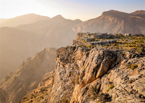
Hiking Inspired by Space Tourism: Trekking Earth's Martian Landscapes
Author: Michael J. Reynolds| Last Updated: May 12, 2026|Reading Time:~18 minutes
Author Background: Michael J. Reynolds is a technology and outdoor systems writer covering the intersection of hiking, mobility, wearable devices, and emerging expedition technologies. His articles examine how developments such as satellite communication, AI-assisted rescue systems, advanced materials, and portable energy solutions are beginning to influence outdoor travel and backcountry safety. He is particularly interested in the practical impact of technology on self-supported trekking and wilderness experiences rather than speculative marketing claims. His work combines industry reports, product research, and long-form analysis to explore how outdoor equipment and mountain travel may evolve over the coming decade.
Commercial spaceflight has edged out of science fiction over the past few years. Space tourism is reshaping how people imagine faraway places. But for most hikers, buying a ticket to low Earth orbit isn't realistic—and honestly, it probably isn't the wilderness experience they're chasing anyway.
According to Fortune Business Insights' 2026 Outdoor & Adventure Sports Equipment Market report (figures cited by AMZ123 in November 2025), the global outdoor gear market hit $18.45 billion this year. Europe accounts for 41.3% of that, North America 25.8%. All that money, chasing something very simple: real ground under real boots.
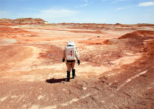
Something interesting has been building quietly. A growing number of hikers are seeking out landscapes on Earth that look uncannily like Mars—walking across the same terrain that scientists use to prepare for future missions. This isn't a gimmick. NASA, ESA, and several private space companies have been running simulations and equipment tests on this kind of terrain for years.
And then there's the gear. Technologies developed for space—water filtration membranes, insulation materials, satellite communication protocols—are trickling into backpacks in surprisingly practical ways. No one's hiking in a spacesuit. But the materials and systems developed for astronauts are starting to show up on the trails. This guide walks through five Mars-analog destinations you can actually visit, the space-derived gear trends worth paying attention to right now, and the risks you need to take seriously before heading out.
Part 1: Mars-Analog Trekking — Five Destinations, Very Different Realities
These places are not created equal. Some are genuinely within reach of a prepared hiker. Others exist mostly in scientific literature and expedition lore. Knowing which is which matters.
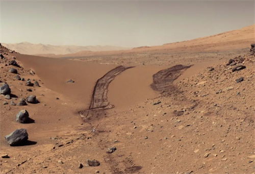
1. Hanksville, Utah — The Public Lands Around MDRS
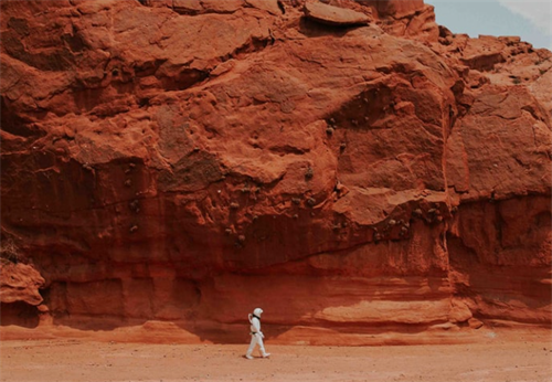
The country around Hanksville, Utah, is probably the most accessible Mars-analog landscape in North America. The geology gets messy in the best possible way—Wingate sandstone, Navajo sandstone, Mancos shale, Morrison and Chinle formations, all stacked into layers of rust red, violet, and ochre. If you've seen rover images from the Martian surface, the resemblance trips something in the brain. Hollywood's location scouts figured this out decades ago. That's why you might recognize the backdrop from Galaxy Quest (1999), Star Trek (2009), or Life (2017).
The Mars Society built its Mars Desert Research Station (MDRS) here for obvious reasons—a two-story simulated habitat with a greenhouse, solar arrays, and robotic observatory and engineering pods. Here's where it gets tricky for hikers hoping to visit: MDRS is a closed research facility. It does not accept visitors. It does not offer tours. The town of Hanksville's official website puts it bluntly: "The Mars Desert Research Station does not see visitors or offer tours. Please stay clear. It is a Point Of Interest only." Pedestrians are allowed along Cow Dung Road and can view the station exterior from authorized parking areas. Entering the facility itself? Not permitted.
For hikers, the real terrain lies on the public lands surrounding the station. Bentonite Hills, Factory Butte, Moonscape Overlook, and Goblin Valley State Park—these form a patchwork of freely accessible zones.
Factory Butte is designated a Special Recreation Management Area by the Bureau of Land Management and remains open to non-motorized hiking. One thing to keep in mind: the area is also open to OHV use, so stay aware of off-road vehicles. Moonscape Overlook has gained traction in hiking circles recently. The views are dramatic. The wind, though, often punishes anyone who gets too close to the edge—and the edges are no joke. Keep a safe distance.
Practical details: From Hanksville, take UT-24 west about 15 miles and turn onto Factory Butte Road. High-clearance 4WD is strongly recommended. Rain turns the road into sticky mud that can swallow a vehicle. Check the forecast. Cell service is unreliable throughout the area—download offline maps before heading out. Spring and autumn offer the most reasonable temperatures. Summer heat regularly exceeds 40°C.
2. Devon Island, Nunavut — The Real "Mars on Earth" That's Mostly Off-Limits
Devon Island sits in the Canadian Arctic Archipelago. It's the largest uninhabited island on the planet, covering roughly 55,247 square kilometers. The centerpiece is the Haughton impact crater—approximately 23 kilometers in diameter, formed by a meteorite strike around 39 million years ago, as the NASA Earth Observatory documented in 2019. The surface textures look disturbingly like Mars.
Since 1999, NASA's Haughton-Mars Project has set up summer camps here. Scientists test Mars habitat designs, spacesuits, and study how teams behave under prolonged isolation. Serious work.
But here's the reality for trekkers: Devon Island has, as local sources describe it, "no towns, no roads, no infrastructure." Getting there means chartering a flight through a research expedition or one of a tiny handful of specialized adventure operators. The annual field season is painfully short. Even in the brief summer, only the coastal lowlands might become snow-free, and the permafrost thaws barely at the surface. Winter temperatures can plunge far below -18°C, and the island sits in darkness for months at a stretch.
This is not a destination for independent hikers. Think of Devon Island less as a trip to plan and more as a story to follow through publicly available scientific reporting. The research coming out of that place is valuable on its own.
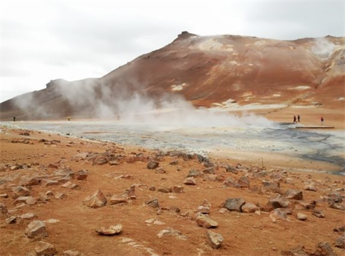
3. Iceland's Interior Highlands — NASA's Geological Reference Site
Iceland's highlands are far more accessible than Devon Island, and they carry genuine scientific weight. According to a November 2025 report from the U.S. Department of Energy's Brookhaven National Laboratory, a growing body of research has identified geological parallels between parts of Iceland and Mars. Both places are dominated by basaltic volcanic rock—a rock type confirmed in Martian meteorites and in data returned by the Curiosity and Perseverance rovers.
NASA researchers visit Iceland's Mars-like deserts, basalt formations, and glacial valleys regularly, testing the same tools and workflows used on Perseverance. A 2025 international study published in American Mineralogist analyzed sedimentary rock samples from Iceland's southwestern watershed, aiming to establish mineralogical methods for interpreting future Mars samples. The researchers flagged a limitation: Iceland's sediments share mineral types with Martian deposits, but they haven't undergone the billion-year compaction and diagenesis that Martian rocks have. The analogies require careful qualification.
For trekkers, the Laugavegur Trail from Landmannalaugar to Þórsmörk—roughly 55 kilometers—cuts through rhyolite mountains with wild color banding and sulfurous hot spring zones. The visual alien-ness of the landscape is hard to overstate. Shorter 2–3 day loops around Þórsmörk are also an option.
A practical note: mountain huts need to be booked months in advance. The highland weather turns brutal fast—clear skies to full storm conditions within hours, even in summer. River crossings are standard. The recommended window is late June through early September.
4. Chile's Atacama Desert — Valle de Marte and Valle de la Luna
Few places on Earth pull double duty the way the Atacama does. It looks like Mars, and the scientific community has treated it as a stand-in for years. In 2017, NASA's Goddard Space Flight Center reported testing a rover prototype here, banking on the extreme aridity to validate life-detection equipment designed for extraterrestrial environments.
How extreme are we talking? The Guinness World Records notes that portions of the Atacama have recorded over 400 consecutive years without a single rainfall. That kind of dryness reconfigures your expectations. Dehydration sneaks up faster than most people anticipate. Whatever water you'd normally carry for a hike of similar distance—double it.
From San Pedro de Atacama, both Valle de Marte (Mars Valley) and Valle de la Luna (Moon Valley) work as day hikes. Valle de Marte sits within the Cordillera de la Sal, surrounded by dunes and eroded rock walls. Route data on Komoot lists the Mars Valley loop at approximately 14.4 kilometers with about 270 meters of elevation gain, rated as moderate.
One detail worth checking locally: Valle de Marte and Valle de la Muerte (Death Valley) have different entry cutoff times for hikers, cyclists, and vehicles. Stop by the local information center for the day's rules.
San Pedro sits at roughly 2,400 meters elevation. Some viewpoints exceed 4,000 meters. Altitude sickness is a real concern—give yourself at least 1–2 days to acclimatize and know the symptoms before you arrive. The payoff? The Atacama has some of the clearest night skies on Earth. Pairing a hike with an evening astronomy session—looking up at the universe from a "Martian" surface—is the kind of experience most hikers consider a highlight. Recommended months: March through May and September through November.
5. Mongolia's Gobi Desert — A Mars Simulation Base Still in Progress
The Gobi Desert ranks among the closest terrestrial approximations to Martian conditions. Temperatures swing between 45°C and -40°C. Iron oxide stains the soil a reddish tint. The MARS-V NGO is currently building a Mars simulation base here, aimed at public visitors.
According to a 2025 CTV News report, the base aims to combine visitor experiences with authentic Mars simulation missions. Official estimates, however, place the earliest public reception no sooner than 2029. Independent hikers cannot visit right now. "Still in progress" is the most accurate description of this destination for the moment.
Part 2: Space-Derived Gear Trends (A 2026 Perspective)
While you're planning hikes to these landscapes, a few gear trends—traceable, in one way or another, to space programs—are worth keeping on your radar.
Aerogel insulation is moving from aerospace into consumer outdoor products. NASA originally used aerogel for collecting space dust and thermal control; it's among the lightest solids known, over 95% air. In December 2025, Outside Online reported that L.L.Bean's new PrimaLoft Packaway Jacket adopted Cross Core insulation with aerogel (60-gram specification), with the manufacturer claiming higher warmth at lower weight. The same year, Sitka's AeroLite jacket integrated silicon aerogel into synthetic insulation, and J.LINDEBERG introduced Solarcore insulation—based on NASA aerogel technology—in its Fall/Winter 2025 sport collection. There are even jackets on the market now that combine aerogel with graphene, marketed as "next-generation mid-layer systems" with lifetime warranties.
These products are available. That's a fact. What's less clear is how aerogel-enhanced insulation holds up over time under repeated compression and damp conditions. Third-party durability data is still thin. Worth watching, but worth watching with a dose of skepticism too.
Direct satellite connectivity is crossing from space operations into backcountry safety. Backpacker magazine's April 2026 issue reported that some smartphones can now connect directly to satellites for SOS signals—no dedicated beacon required. According to feedback from the Colorado Search and Rescue Association cited in that article, smartphone satellite SOS positional accuracy is broadly comparable to dedicated devices like the Garmin inReach, typically within a few meters to around ten meters. But search and rescue teams have also noticed an uptick in non-emergency activations. Lower barrier to use, more accidental calls.
The rollout isn't uniform, though. Europe remains more fragmented than North America. Business Reporter noted in March 2026 that Vodafone and AST SpaceMobile are planning satellite coverage for Europe. They had UK regulatory approval and had completed commercial testing by March 2026, but formal service hadn't launched yet. Meanwhile, French startup Sateliot is collaborating with Outdoor Aficionados to integrate its 5G IoT satellite network into OXI safety beacons (per Sateliot's 2025 press release), aiming for global SOS messaging and peer-to-peer short messaging.
The overall direction is clear: satellite connectivity is becoming more widespread. But the technology's real-world reliability and coverage are still maturing. For hikers heading to the Mars-analog destinations described above—places where mobile signal is already poor—relying entirely on a smartphone's built-in satellite feature carries a degree of risk. Most professionals recommend carrying a backup power source and understanding the practical differences between a dedicated satellite communicator and a smartphone-based SOS.
Part 3: Before You Go — What Not to Overlook
Verify land boundaries first. What satellite imagery shows as continuous red desert is often a patchwork of private land, federally managed research zones, and open recreation areas. The area around MDRS is a textbook example. Consult the relevant land management agency or national park website for current regulations before setting out.
Carry satellite communication and have a backup plan. Most of the destinations discussed here sit deep inside mobile dead zones. Beyond carrying a device, share your itinerary and expected return time with a reliable contact. Agree on a plan for what they should do if you don't check in by a specified time.
Don't underestimate altitude sickness or dehydration rates. The Atacama and parts of the Icelandic highlands sit above 2,500 meters, and extreme dryness accelerates fluid loss. Give yourself at least 1–2 days to acclimatize. Consult a travel medicine professional. Carry more water and electrolyte supplies than standard calculations suggest.
Keep expectations about gear claims reasonable. Jackets with space-grade materials have real potential, but they're still designed for terrestrial conditions. The long-term performance of aerogel insulation under repeated compression and moisture exposure hasn't been independently verified at scale. Satellite SOS availability varies by country and region—it's not a universal fallback.
FAQ
Can regular hikers actually visit these "Martian" landscapes?
Most of them, yes—with important caveats. Valle de Marte and Valle de la Luna in the Atacama, Bentonite Hills, and Factory Butte in Utah are all open to the public with proper preparation. But Devon Island in the High Arctic remains effectively accessible only to research teams and a very small number of specialized expedition groups. The Gobi Desert simulation base doesn't expect public visitors until 2029 at the earliest.
Are special permits required?
Depends on the location. Factory Butte is BLM-managed open recreation land and generally doesn't require permits for non-motorized hiking. The Atacama's Mars Valley and Moon Valley usually require entrance tickets during regular hours. MDRS is a private research facility—tourists and tour operators are prohibited. Always check the relevant land management agency or national park website for current rules.
Is it safe to go alone?
Not recommended. These areas tend to be remote, with poor or no mobile signal and few resupply points. Going with a partner or booking through a qualified local guide is the more reliable approach.
What's the best season?
It varies completely. Atacama: March–May and September–November. Hanksville area, Utah: spring and autumn. Iceland's highlands: late June through early September. Devon Island offers virtually no seasonal window for independent hikers.
References
[1] Fortune Business Insights. (2026). Outdoor & Adventure Sports Equipment Market [figures cited by AMZ123, November 2025]. https://www.amz123.com/t/FiVVgAlg
[2] Brookhaven National Laboratory. (2025, November). Destination: Mars. First Stop: Iceland? https://www.bnl.gov/newsroom/news.php?a=121644
[3] Friends of NASA. (2025, December). Exploring Iceland Like It's Mars: NASA Scientists Test Life-Seeking Strategies. https://www.friendsofnasa.org/2025/12/exploring-iceland-like-its-mars-nasa.html
[4] Outside Online. (2025, December). Does Your Jacket Have NASA Tech? https://www.outsideonline.com/outdoor-gear/clothing-apparel/does-your-jacket-have-nasa-tech/
[5] Backpacker. (2026, April). Is the Garmin inReach Obsolete? How the Newest Smartphones Stack Up in the Backcountry. https://www.backpacker.com/survival/satellite-smartphone-messaging-is-changing-search-and-rescue-but-can-you-trust-your-life-to-it/
[6] Town of Hanksville Official Website, Mars Society page, MDRS advisory. https://www.hanksvilleutah.gov/de/mars-on-earth
[7] NASA Earth Observatory. (2019). Haughton Impact Crater.
[8] Guinness World Records. Longest dry period.
[9] NASA Goddard Space Flight Center. (2017). NASA Tests Life-Detection Drill in Earth's Driest Place.
[10] Sateliot. (2025). Press release: Sateliot Partners with Outdoor Aficionados for 5G IoT SOS Beacon.
Disclaimer
This article is for informational and educational purposes only and does not constitute professional outdoor instruction, travel advice, or safety guarantees. Hiking and outdoor activities carry inherent risks, including the possibility of injury or death. The destinations, routes, and equipment information discussed are based on publicly available research. The author does not recommend any specific location based on firsthand experience or professional qualification. Readers are fully responsible for their own outdoor activities and should independently verify all relevant information—including weather forecasts, route conditions, land access restrictions, local regulations, and equipment suitability—before planning any trip. Decisions should be based on individual ability, experience, and actual on-the-ground conditions. For high-difficulty hikes, high-altitude activities, or travel in remote areas, consult a certified professional guide or relevant medical professional. The author assumes no liability for any loss, injury, or damage arising from use of this guide.
Recommend for you:
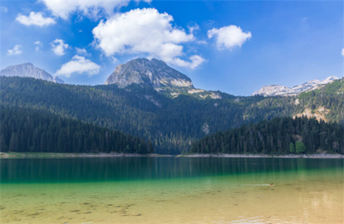
Durmitor National Park: Montenegro's Most Underrated Summit Destination
If you've grown tired of crowded Alpine trekking corridors in the Dolomites or the Swiss Alps, Durmitor National Park offers a very different mountain experience.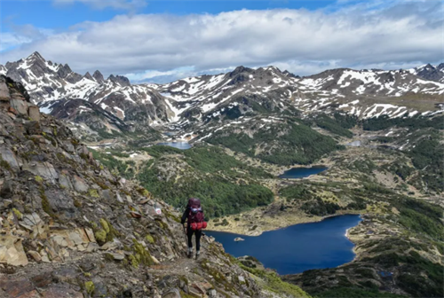
Dientes de Navarino Circuit: A Wilderness Trek at the End of the World
The route is a loop across the island’s jagged mountain spine. It measures roughly 53 to 54 kilometres, a figure confirmed by the official leaflet from Chile’s Ministry of National Assets and the independently produced Kanaska Maps project.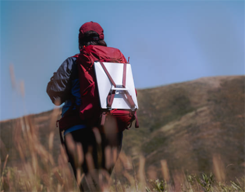
First Hikers Using Starlink: What High-Speed Internet Does to the Wilderness Experience
In June 2024, SpaceX launched the Starlink Mini. It weighs 1.1 kg (2.43 lbs), according to SpaceX’s official specifications page, or 1.53 kg (3.37 lbs) with its 15-meter DC power cable and kickstand—and it fits in a backpack.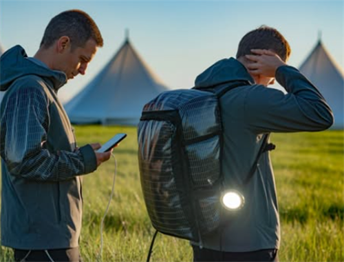
Solar Fabric Tents and Self-Heating Jackets: The Next Generation of Gear
Two ideas keep surfacing in hiking circles these days: tent fabric that generates electricity, and jackets that warm themselves up.