Trekking Oman's Hajar Mountains: Canyons and Ghost Villages
————This guide is intended for experienced independent trekkers planning multi-day routes in remote terrain

By Elias Thorne|Release date: May 8, 2026|Reading time: ~15 minutes
Author Background: Elias Thorne is an outdoor travel writer focusing on remote trekking routes, mountain communities, and long-distance hiking culture across Eastern Europe, Central Asia, and South America. His work centers on practical route analysis, seasonal conditions, and the realities of traveling in less-developed mountain regions rather than luxury tourism. He has spent years researching trekking infrastructure, trail logistics, and changing tourism patterns in destinations such as Albania, Montenegro, Oman, and Patagonia. His articles combine publicly available research, guidebook references, and field reports from hiking communities to help readers better understand remote routes before planning their own journeys.
In northern Oman, under the shadow of limestone cliffs, there are stone villages where half the roofs have caved in. They don't show up on the main pages of most conventional guidebooks. But you can find them on Wikiloc and AllTrails, pinned under trekking routes that cut straight through. These half-abandoned settlements — local hikers and visiting trekkers often call them "ghost villages" — are becoming one of the most distinctive backdrops to multi-day routes in the Hajar Mountains.
International tourism flows in the region are shifting in measurable ways. Oman received a total of 3.89 million visitors by the end of December 2024, according to data released by the National Center for Statistics and Information. That represents a 15% increase in international tourism arrivals compared to 2019. Between September 2024 and August 2025, the country saw a further 7% growth in international tourist arrivals, with European and Asian markets driving much of that increase. Most of this traffic still concentrates in Muscat and the coastal resort strip. But in independent trekking circles, the Western Hajar is starting to appear as an offbeat alternative. It's not the next "must-visit" destination. It looks more like a place where a few people have already gone, and many more are now gathering information.
This guide offers hikers from North America and Europe an evidence-based overview of trekking in the Hajar Mountains. The content draws on industry reports, published guidebooks, academic literature, and community-shared GPS tracks. All information comes from publicly available records. Facts and observations are clearly separated throughout.
Where it is, and what makes it different
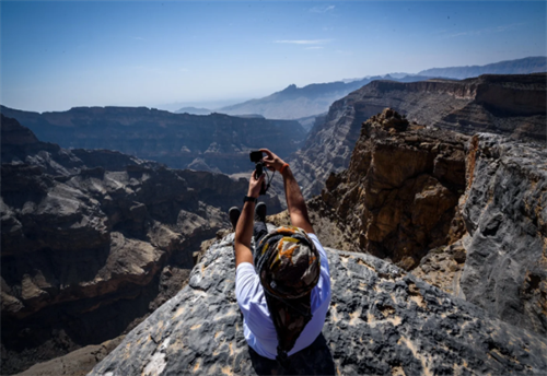
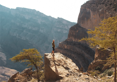
The Hajar Mountains arc along Oman's northern coastline, stretching roughly 700 kilometers from the Musandam Peninsula in the northwest to near Sur in the east. The range splits into the Western Hajar and Eastern Hajar. The Western Hajar is predominantly limestone and holds one of the most dramatic canyon systems in the Middle East. Jebel Shams, Oman's highest peak, reaches about 3,009 meters. The canyon it overlooks, Wadi Nakhr, cuts to a depth of roughly 1,000 meters.
Some tourism materials call Wadi Nakhr the "Grand Canyon of Arabia." That label helps visitors picture it. But it can be misleading. Arizona's Grand Canyon exceeds 1,800 meters in depth in places — nearly double. Oman's canyon is impressive on its own terms, without needing the comparison.
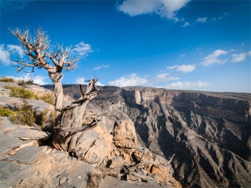
A 2018 paper in Earth-Science Reviews traced the geological evolution of the Hajar Mountains. It showed that the limestone layers here record a carbonate platform that once sat on the edge of the Arabian Plate during the Late Cretaceous. When plates collided, those layers were thrust upward into their present position. The tilted, sometimes nearly vertical strata under a trekker's boots are, literally, the remains of an ancient sea.
Oman's ancient falaj irrigation systems are part of this landscape, too. Five Omani aflaj were inscribed on the UNESCO World Heritage List in 2006. A 2025 study by the University of Nizwa's UNESCO Chair on Aflaj Studies examined how these traditional water channels function as more than irrigation tools — they serve as frameworks for cooperation across communities. However, the research also noted that urbanization and environmental stress now pose threats to their continued function.
Hikers passing through certain wadis might hear the persistent, quiet drip of a water channel still in use. That sound keeps appearing in route reports, because it contrasts so sharply with the bone-dry mountainsides around it.
The routes: from a half-day ledge to multi-day crossings
Route information below combines details from Oman Trekking: A Guide to the Hajar Mountains & Wadi Valleys (Explorer Publishing, 2020), the Oman Ministry of Tourism's archived digital brochure Adventure Trekking in Oman, and GPS tracks from multiple users on Wikiloc and AllTrails.
1. Jebel Shams Balcony Walk
This is the most documented hike in the Hajar Mountains. It takes about 4 to 6 hours round trip, turning around at the semi-abandoned village of As Sab. The path follows an old donkey trail along the north face of Jebel Shams.
Most of the trail is clear, but the exposure is serious. The path cuts directly across the cliff face, with a drop of several hundred meters on the right. Community forum notes warn that condensation on the limestone surface can make it slippery in the early morning, and even days after rain. This isn't a technical climbing section. But losing friction underfoot here has severe consequences.
As Sab still has a few stone houses with crooked lintels and partial roofs. It looks less abandoned than suspended. Some trekkers have noted that fresh dates occasionally appear on doorsteps — thought to be a form of barter exchange still operating between local residents.
The starting point is a hamlet called Khateem, near the Jabal Shams Resort. Local children sometimes greet arriving vehicles, offering small woven trinkets made from the fleece of the long-haired goats that browse the mountainsides. Count on around three hours for the return journey from Khateem to As Sab, though even a ten-minute walk from the start offers a good sense of the scenery.
Keywords: Wadi Ghul hike, Jebel Shams Balcony Walk, Oman trekking.
2. Wadi Bani Awf to Bilad Sayt crossing
This is a classic multi-day snake-canyon traverse, typically taking 2 to 3 days. The trek starts near Al Hamra, enters Wadi Bani Awf, threads through tight bends and several cliff traverses, and eventually reaches the restored mountain village of Bilad Sayt.
In geomorphological terms, Wadi Bani Awf displays the archetypal dry valley form of the Hajar range. The floor is paved with cobbles hauled by episodic floods. On both sides, grey-white limestone walls reveal sedimentary textures and structural folds — rock layers that were once horizontal, now tilted sharply skyward or compressed into tight waves. Within a few steps a trekker can see strata deformed over hundreds of millions of years.
For hikers, the real concern is flood risk. Oman's Ministry of Agriculture and Water Resources has commissioned comprehensive flood hazard mapping across the country, including wadis in Al Dakhiliyah governorate, where much of the Western Hajar sits. In narrow upstream sections like those in Wadi Bani Awf, flash floods can develop rapidly — even when the sky overhead is clear, distant rainfall can send water rushing through the canyon with little warning.
The endpoint, Bilad Sayt, is often the emotional high point of this route. The village has undergone some restoration, its stone houses stepping up the hillside in layers. But what fixes a trekker's attention is often the opposite slope: clusters of completely collapsed stone heaps that no restoration project has touched. The Wadi Bani Awf watershed alone contains about 50 abandoned settlements, with Balad Seet being the largest.
3. Jebel Akhdar to Wadi Muaydin traverse
This is one of the longest coherent trekking routes in the Western Hajar, typically taking 4 to 5 days. The Jebel Akhdar plateau sits at about 2,000 meters and is known for terraced rose cultivation. The descent from the plateau edge into Wadi Muaydin is frequently flagged as the crux on community GPS tracks.
The problem is collapsed terrace paths. Old walking routes that once connected the plateau to the valley floor have partly disintegrated. Trekkers need to find their own viable descent lines across scree slopes. Analysis of Wikiloc tracks shows that on the lower half of this descent, actual paths often swing 50 to 80 meters on either side of the marked track line. There is no single correct route — only multiple acceptable variants.
This route passes through the highest concentration of abandoned villages in the Western Hajar. The Wadi Bani Awf watershed alone holds about 50 such settlements, and other valleys in the region contain additional sites. Most stone walls are still standing. Roof beams have long since snapped and collapsed. Standing in an empty alley, the only sound might be wind squeezing through gaps in the stonework.
A practical note: there is no unified trail-marking system on the entire Jebel Akhdar to Wadi Muaydin route. This trek depends heavily on offline maps and terrain-reading skills. It is not suitable for anyone without prior experience trekking in the Western Hajar.
4. A lesser-known side route: Wadi Sahtan
Wadi Sahtan gets only a brief mention in existing guidebooks, but a small number of GPS tracks can be found on Wikiloc. Its entrance looks almost identical to several neighboring side wadis — same width at the mouth, same limestone color, same type of alluvial fan. Judging by eye alone, the chance of walking into the wrong branch is not low.
The draw of this side route is a few clusters of stone houses that are completely unrenovated and unlabeled on any mainstream map. The trade-off is rougher going: you'll push through thorny scrub repeatedly and cross the baked floors of old water cisterns. This route makes sense for people who have already built up experience in the range. For first-timers, it can stay on the next-trip list.
Access conditions and transport realities
Most trekking areas in the Western Hajar do not require a special hiking permit. But the mountain roads leading up to Jebel Shams and Jebel Akhdar have police checkpoints. The rule is explicit: only 4WD vehicles are allowed past. This is not a recommendation. It is a hard access condition — 2WD sedans are turned around. The road to Jebel Shams is surfaced for about the first half, but nearer the top the tarmac gives out and the track becomes steep and rocky.
Oman's road network stretches more than 5,000 kilometers. But the spur roads from main towns to trek entry points are often unpaved dirt and gravel tracks. From Nizwa to Al Hamra is about 35 kilometers. From Al Hamra into specific wadi entrances typically adds another 30 to 60 minutes of off-road driving. On some routes, you can take a shared taxi as far as the village. After that, everything moves on foot.
Mobile network coverage is absent across most inner wadis. Oman's civil defense authority does not maintain a permanent mountain rescue post in the Western Hajar. Multiple guidebooks and operator trip notes recommend carrying a satellite communication device — a Garmin inReach or Iridium satellite phone — on multi-day routes.
Season and safety windows
Published guides and operator data bracket the main trekking season from mid-October through early April. Here's how the season breaks down:
Mid-October to November: The most balanced temperature conditions. Daytime wadi-bottom temperatures are usually between 20°C and 28°C. Nights at altitude are around 5°C to 10°C. Rain is less likely during this window, but not impossible.
December to February: Nighttime temperatures can drop to near or below freezing. High-altitude camps require a sleeping system suited for cold conditions. For trekkers from Northern Europe or North America, these temperatures may be close to their usual winter hiking conditions — making this a viable long-distance option in the off-season. Freeze-thaw cycles can loosen surface scree on some sections, increasing slip risks.
May to September: Wadi-bottom temperatures regularly exceed 40°C. The risk of heat exhaustion and dehydration rises sharply. Most guidebooks advise against multi-day routes during this period.
Flash floods deserve particular attention. The usual impression is that Oman is a dry winter-sun destination. But the Western Hajar is not immune to sudden floods. Oman has conducted comprehensive flood hazard mapping across areas prone to flash flooding, including Al Dakhiliyah governorate, where much of the Western Hajar is located. Even during November or February, narrow wadis can experience rapid water rise from distant convective storms. Checking an updated weather forecast daily is not optional.
Supplies, water, and camping
Oman does not have a teahouse or hut network comparable to Nepal or the Alps. All food, fuel, and drinking water must be bought in towns before entering the mountains. The most frequently used resupply points are Al Hamra, Birkat Al Mouz, and Nizwa.
Water is the tightest constraint on any itinerary. Most wadis stay completely dry during the dry season. The few residual pools have water quality that varies and often turns dark, murky green — undrinkable without treatment. Several guidebooks recommend carrying 4 to 6 liters of drinking water per person per day, plus purification tablets or a squeeze filter for any unexpected water sources.
Camping is standard practice. When choosing a site, two priorities stand out: avoid the base of vertical cliffs to lower rockfall risk at night, and pick sandy or fine-gravel patches. In a narrow valley bottom, these usually mean marginally more level ground. Terraced platforms near villages are occasionally used, but this requires prior consent from villagers — some terraces remain in active cultivation.
Ghost villages, community, and the mountain economy
Many villages that trekkers assume are completely abandoned are actually in semi-seasonal use. Some families move to higher ground in summer and return in winter. Others come back during the date harvest or after Ramadan and stay for several weeks. The Oman Ministry of Tourism's brochure describes these settlements as "not uninhabited but following an intermittent rhythm of occupation."
When entering a village, no matter how ruined the mosque looks, do not enter without a clear invitation from a local. If you see fresh dates on a doorstep or old currency held down by a stone, do not touch them. This is a long-standing form of barter within local communities.
Being invited for Omani coffee is a common social interaction. By custom, accepting the first cup is a basic form of respect. Declining can be read as distance — and that becomes awkward when you later need to ask about the condition of water sources or the trail ahead.
Oman has more than 4,000 aflaj across the country, of which over 3,000 remain active. Passing hikers may encounter water channels that are still maintained by the communities they serve. These systems are not museum pieces.
Hiring a local guide or porter is one of the most direct ways your spending supports the mountain economy. On longer, more navigation-intensive routes, a guide who knows which trail sections have collapsed recently also brings practical value.
FAQ:
Can you trek independently in the Hajar Mountains?
For routes with well-documented GPS tracks, such as Wadi Bani Awf and the Jebel Shams Balcony Walk, independent trekking is feasible during the right season if you have solid offline navigation skills. But keep in mind that if you twist an ankle in a wadi, there may be no phone signal and passing herders are not frequent. Solo travel raises the risk level considerably. The Jebel Akhdar to Wadi Muaydin traverse and side routes like Wadi Sahtan are not well suited to independent attempts under current conditions.
Do I need to carry a tent?
Yes. There is no mountain hut network in the core trekking areas. The roofs of abandoned stone houses are too unstable to rely on for overnight shelter. Any multi-day itinerary requires your own tent and full sleep system.
What should women and minority travelers keep in mind?
Oman's social norms on dress are generally more relaxed than in most Gulf countries. In village areas, however, clothing that covers the shoulders and knees is still advisable. Most trekkers handle this by wearing a lightweight long-sleeved shirt over a short-sleeved top. It also helps with temperature changes in shaded spots. The outdoor community has not reported substantive barriers in this regard, but personal judgment always needs to factor in the specific route and the time of the visit.
Can I resupply food along the way?
Homestays in villages near trailheads, such as those around Al Hamra and the Seven Lakes area, can sometimes provide basics — bread, rice, potatoes, and tinned goods. Fresh fruit and vegetables are scarce in most seasons. Plan to buy all main meals and trail snacks in larger towns like Nizwa before heading into the mountains.
References
[1] Lecomte, B. Oman Trekking: A Guide to the Hajar Mountains & Wadi Valleys. Explorer Publishing, 2020.
[2] Kusky, T.M. et al. "Geological evolution of the Al Hajar Mountains." Earth-Science Reviews, 2018.
[3] "Aflaj Irrigation Systems of Oman." UNESCO World Heritage List, 2006.
[4] Oman Ministry of Agriculture and Water Resources. Flood hazard mapping studies for wadi systems in Al Dakhiliyah and neighboring governorates, 2023.
[5] Sultanate of Oman Ministry of Tourism. Adventure Trekking in Oman (archived digital brochure), 2021.
[6] Travel And Tour World. "Oman Sees Seven Percent Growth in International Tourist Arrivals." November 2025.
[7] Oman Observer. "Oman ranked among the top tourist destinations in MEA." February 2025.
Disclaimer
This article is based on published guidebooks, official tourism brochures, academic literature, and publicly available community GPS tracks and reports. The difficulty assessments, safety notes, and seasonal advice reflect general conditions during specific times and weather windows. Mountain and canyon environments carry unpredictable risks, including but not limited to flash floods, extreme heat, rockfall, and navigational challenges. Visa rules and access restrictions may change after publication. Readers should assess their own abilities and risk tolerance and are strongly advised to verify current route conditions and access requirements with a licensed outdoor operator or certified guide in Oman before departure. The author and publisher accept no legal liability for any personal injury, property loss, or travel delay resulting from the use of this information.
Recommend for you:
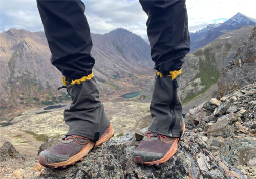
Gaiters: Are They Worth It on Rocky, Scree-Filled Trails?
When a hiker climbs from treeline into a high scree basin, a tiny decision starts to grow: gaiters or no gaiters.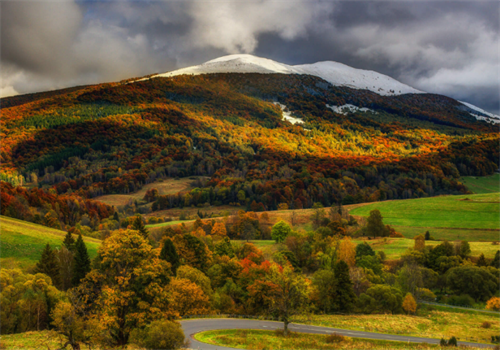
Bieszczady: Poland's Remote Eastern Wilderness
The Bieszczady Mountains sit at Poland's southeastern corner, bordering Slovakia and Ukraine.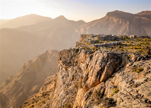
Trekking Oman's Hajar Mountains: Canyons and Ghost Villages
In northern Oman, under the shadow of limestone cliffs, there are stone villages where half the roofs have caved in. They don't show up on the main pages of most conventional guidebooks.
No More Missing Hikers? How AI-Powered Search-and-Rescue Drones Operate
Hikers go missing for reasons that sound almost mundane: a weather front rolls in faster than expected, someone loses the trail, a phone battery dies, and the last thread of contact snaps.