No More Missing Hikers? How AI-Powered Search-and-Rescue Drones Operate
Author: Michael J. Reynolds| Release date: May 12, 2026 | Reading time: ~10 minutes
Author Background: Michael J. Reynolds is a technology and outdoor systems writer covering the intersection of hiking, mobility, wearable devices, and emerging expedition technologies. His articles examine how developments such as satellite communication, AI-assisted rescue systems, advanced materials, and portable energy solutions are beginning to influence outdoor travel and backcountry safety. He is particularly interested in the practical impact of technology on self-supported trekking and wilderness experiences rather than speculative marketing claims. His work combines industry reports, product research, and long-form analysis to explore how outdoor equipment and mountain travel may evolve over the coming decade.
The U.S. National Park Service handles several thousand search-and-rescue incidents each year inside the lands it manages — events that collectively eat up tens of thousands of staff hours, according to the agency’s own public tallies. Hikers go missing for reasons that sound almost mundane: a weather front rolls in faster than expected, someone loses the trail, a phone battery dies, and the last thread of contact snaps.
For search teams, none of that is abstract. They’re left covering ground measured in square kilometers, often with no cell signal, in terrain that seems designed to hide a human body. Dense brush, broken ridgelines, shadows that shift by the hour.
Autonomous flight, AI image recognition, and thermal imaging have entered mountain rescue against that backdrop. But the systems are not widespread, and they come with real limits. “No more missing hikers” is a direction to prod at. It is not a settled fact.
Why wilderness search is genuinely hard
Most searches start with almost nothing. A parked car. A phone’s last ping. A rough itinerary texted to a friend three days ago. The gap between that last known position and where a person ends up can swallow whole drainages.
Weather and light shrink the options fast. Helicopters get grounded by low cloud. Ground teams inch across wet rock and loose scree. Thermal cameras can sense the temperature gap between a warm body and cooler ground, but the real world doesn’t cooperate neatly. Rocks hold heat. Tree trunks hold heat. A good insulated jacket can nearly erase someone from the thermal picture, especially in the afternoon. Any technology arriving on scene starts from the same difficult place as everyone else: what is actually known at the outset is frighteningly little.
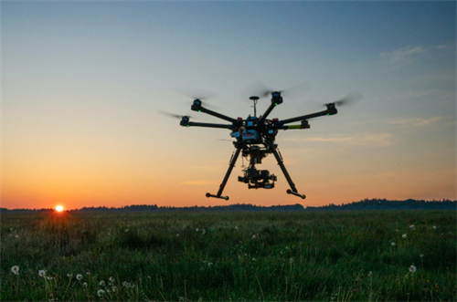
How drones entered search work — the shift from remote control to AI assistance
Early on, search drones mostly did what a helicopter could do, just cheaper: take overhead photos that a human then had to watch, frame by frame, looking for clues.
That changed when on-board processing and machine learning models started showing up on the aircraft itself. A drone can now scan imagery in flight and flag shapes that look like a human silhouette, a patch of color that doesn’t fit, a backpack shape. It pushes those candidates to a human operator. The machine filters. The person decides. That division of labor — crude as it sounds — is what most “AI search drone” systems actually mean in practice right now.
Then there’s the multi-drone question. A single aircraft covers a strip of ground until its battery gives out. A 2025 study from the Korean Society of Computer and Information tested multi-drone path algorithms that divide a search grid automatically and reported full coverage inside a defined test area. Simulation results, clean and tidy. In the field, coordinating multiple aircraft means wrestling with communication links, airspace conflicts, and a cascade of failure points. Flying one drone in mountain terrain is demanding. Flying several at once is a different problem entirely.
How an AI-powered SAR drone actually works?
Visible light and thermal cameras: each has strengths, each has blank spots
Visible-light cameras paired with deep-learning object detectors scan for anything that breaks the texture of the ground — a body, a jacket, a piece of gear. At night, without an illuminator, they’re blind. Under a closed canopy, they’re mostly blind.
Thermal imaging picks up part of the slack. A team at the Polytechnic University of Milan published results in Remote Sensing in 2025 (DOI: 10.3390/rs17173032) from a processing pipeline that combined thermal video tracking with camera motion compensation. On their test dataset, precision hit 90.3%. Recall reached 73.4%. That second number means the system missed more than a quarter of targets it should have flagged. And those results came from a dataset where sun-warmed branches still sometimes fooled the algorithm into seeing a person-shaped heat blob where none existed.
Across real search missions, the pattern is consistent enough: thermal works best in early morning cold. In afternoon heat over sun-baked rock, or under thick canopy, its reliability drops hard. No practical sensor today peers through a dense forest ceiling and picks out a person.
Autonomous navigation: maps, obstacles, and the cost of being careful
Fly a drone into a canyon or forest without GPS and it has to build a local map in real time — lidar, visual SLAM — and then avoid whatever it finds.
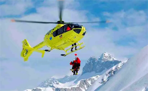
Rega, the Swiss air-rescue organization, describes its search drone on its official website (rega.ch): the aircraft flies at 80 to 100 meters, follows a pre-planned route using satellite navigation and a collision-avoidance system, detects helicopters and cables, and carries an emergency parachute. That is a high-end, purpose-built system with serious engineering behind it. Most civilian-grade setups operating near trees take a much more conservative line. They climb higher. They fly slower. They trade image detail for a margin of safety, because a crash doesn’t just wreck a machine — it terminates the search.
Communication relay: signal doesn’t need a sight line, but it does need a live phone
Where cell coverage drops to zero, a drone carrying a relay payload can act as a temporary tower, restoring basic signal above a radio shadow zone.
The advantage here is genuinely different from optical sensing. Radio frequencies punch through some foliage and obstacles. Research trends indicate that, under the right conditions, a search team can detect the presence of a missing person’s phone even if that person cannot actively use it. But the method has a hard dependency: the phone has to have power and be able to respond to network queries. Prolonged exposure in the backcountry — cold nights, damp conditions — makes that a fragile bet.
Predictive search: planning help, not a shortcut around experience
Before a search even begins, the sharpest question is usually “where,” not “what tool.” A small number of research groups are applying machine learning to historical lost-person records, terrain data, and movement patterns to estimate likely routes.
Researchers from the University of Zurich and the Dalle Molle Institute for Artificial Intelligence built a deep neural network system that recognizes mountain trails and guesses the right direction on unfamiliar paths with roughly 85% accuracy, as reported in their published paper. Useful. But industry reports repeatedly caution that these models behave differently from one mountain environment to another. For now, they’re treated as planning aids that help narrow a search sector. They don’t replace an experienced commander who knows the ground and how people actually move through it.
The systems currently being attempted in reality
The examples that follow come from official releases and public coverage. They’re snapshots — specific conditions, specific places — not a claim about how things work everywhere.
Rega, Switzerland. Rega’s 2026 published information notes roughly 18 months of testing and about 160 search missions flown with its autonomous drone alongside rescue partners. The drone gets deployed when weather grounds the helicopters. Rega states plainly that the drone assists; it does not carry out a rescue by itself.
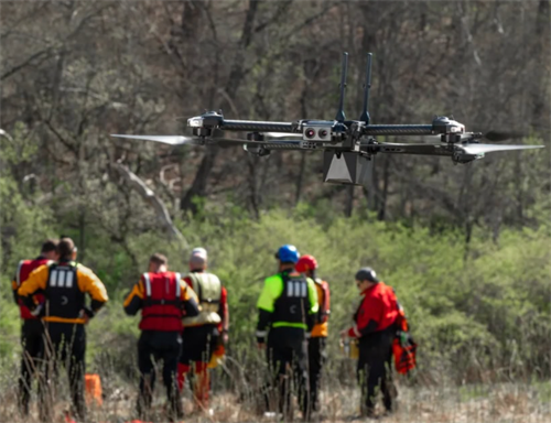
SARAA-Scotland. This charity, founded in 2018, now counts 26 qualified drone pilots and 11 aircraft drawn from 12 Scottish mountain rescue teams, according to its own 2025 public material. That same year, SARAA-Scotland participated in a multi-day search in the Torridon area, running different drone types and visual recognition software against complex mountain terrain.
Local agencies in the United States. sUAS News reported in 2025 that police in Ocean Township, New Jersey, used a DJI Matrice 30T with a thermal camera and found a missing teenager hidden in dense brush 17 minutes after the drone launched. In Virginia, Rockbridge County’s Public Safety Communications Center logged 157 missions and 30 flight hours in 2025 using enterprise-grade thermal drones, per the county’s own published newsletter.
Read these examples together and the picture is clear: the technology is being tested, not standardized. In the vast majority of mountain regions, the primary response remains a helicopter crew or a team on foot.
What this means for hikers
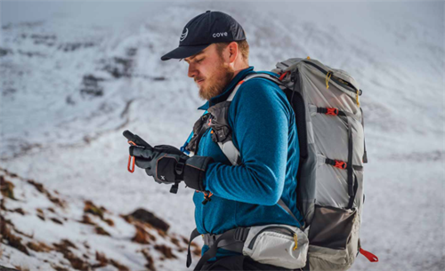
Color choice matters more than most people think. Whether a drone is looking with visible light or thermal, it needs contrast. A bright hat catches a visual algorithm far more reliably than a dark gray or olive jacket. Reflective strips or a headlamp can open extra chances of being spotted at night. You don’t need special equipment. You just need to weigh this factor when you pack.
Make sure your devices actually work when they have to. If the battery in your satellite messenger or personal locator beacon is dead at the critical moment, the location window it might have provided is gone. Check the charge before you leave. Test the signal. Make sure the waterproofing holds. These small steps directly affect how fast a search can shrink the target area.
Leave a plan. A drone, once airborne, still has to answer a basic question: where do I fly? Leaving your intended route, a backup route, and an expected return time with someone you trust fundamentally improves the odds that the initial search grid overlaps where you actually are.
Know the ground, and keep your expectations honest. Learning about the rescue setup where you’re headed is just practical trip planning. A few regions have drones integrated into their search capability. Most mountain areas — including popular destinations in North America and Europe — still default to ground teams and crewed aircraft. Don’t let the existence of a technology push you onto terrain that exceeds your ability.
A cautious look forward
AI-driven search drones are changing how backcountry missing-person incidents get handled, but the change is quiet and gradual.
Algorithms that perform well in controlled test conditions degrade predictably under shifting light, sudden weather, and thick vegetation. Thermal tracking with motion compensation has delivered solid precision numbers. It has also delivered recall figures that leave a quarter or more of targets unseen. Communication relays offer a real edge in signal penetration but lean heavily on a factor nobody controls: phone battery life. Multi-drone search looks excellent in simulation and significantly harder the moment terrain gets involved.
Technology can shorten search times. It does not replace careful judgment in the mountains. That hasn’t changed, and nothing on the horizon suggests it will.
FAQ
Q1: Can a search drone actually spot someone in a dense forest from the air?
It depends heavily on the season, the vegetation, and the sensors on board. Deciduous forest outside summer is easier for visual cameras than dense evergreen cover. Thermal imaging works best in early cold and degrades in afternoon heat over rocky terrain or under a thick canopy. No practical sensor today peers through a fully closed forest ceiling.
Q2: If my phone is dead, can a drone still find me?
Yes. The drone does not depend on your phone. It uses its own optical and thermal cameras. But if a satellite messenger or emergency beacon successfully sends your coordinates, the search area narrows enormously, and that speeds up detection by any platform.
Q3: How common are AI search drones in North American and European mountains?
As of early 2026, they remain limited to pilot programs and specialist teams, far from standard deployment. Some areas in the Alps, the Rockies, and the Scottish Highlands have started limited use. In most mountains, a helicopter or ground team is still the primary response.
Q4: Do I need to buy special gear to be more visible to a drone?
No. But your clothing choices do make a difference. Bright, high-contrast items, reflective patches, or a headlamp can improve detection odds from the air without adding significant cost or weight.
Q5: Will AI drones eventually replace human SAR personnel?
In the near term, extremely unlikely. Drones and AI work best as a filtering tool to quickly scan large areas. Confirming a target and carrying out an actual rescue still require trained people on the ground.
References
[1] Karaca, Y., et al. (2018). The Use of Unmanned Aerial Vehicles in Mountain Search and Rescue: A Systematic Review. The American Journal of Emergency Medicine, 36(7), 1292–1300.
[2] Adams, S. M., & Friedland, C. J. (2021). A Survey of Unmanned Aerial Vehicles for Wilderness Search and Rescue. Journal of Field Robotics, 38(6), 966–985.
[3] Puleio, A., et al. (2025). Enhancing Search and Rescue Missions with UAV Thermal Video Tracking. Remote Sensing, 17(17), 3032. The 90.3% precision and 73.4% recall figures are drawn from the results section of this paper.
[4] Rega. (2026). Search and Rescue Competence Centre. Swiss Air-Rescue. Data on the roughly 160 missions and 18-month test period come from official Rega publications at rega.ch.
[5] Lee, D.-H., et al. (2025). Platform for Missing Person Search and Rescue Systems in Disaster Areas Using AI-Based Drone Video Analysis. Journal of The Korea Society of Computer and Information, 30(8), 111–120.
Additional public sources consulted: the SARAA-Scotland website (saraa-scotland.org, accessed 2025) for pilot and fleet figures and the Torridon search description; a 2025 sUAS News report covering the Ocean Township thermal drone incident; the 2025 Rockbridge County newsletter documenting 157 missions and 30 flight hours; and the University of Zurich / Dalle Molle Institute research paper describing the trail-detection system and its accuracy rate.
(References listed are publicly available studies, official reports, and press accounts. Readers are encouraged to consult the original sources for full details.)
Disclaimer
This article is based on publicly available research, industry reports, and technical documentation current to May 2026. It is provided for informational purposes only and does not constitute professional rescue advice or a safety guarantee. Backcountry travel involves inherent risks. Readers should independently assess their route, weather conditions, and personal ability before each trip and follow the safety guidance of local official bodies. Mention of any technology, platform, or project does not imply endorsement of its effectiveness, availability, or suitability.
Recommend for you:
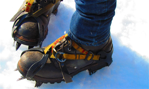
Crampons vs. Microspikes: What You Need for Spring Snow Hiking
Spring snow hiking — roughly March through May in the Northern Hemisphere — has a way of fooling you.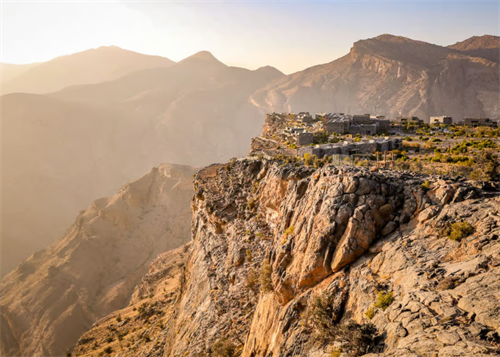
Trekking Oman's Hajar Mountains: Canyons and Ghost Villages
In northern Oman, under the shadow of limestone cliffs, there are stone villages where half the roofs have caved in. They don't show up on the main pages of most conventional guidebooks.
Durmitor National Park: Montenegro's Most Underrated Summit Destination
If you've grown tired of crowded Alpine trekking corridors in the Dolomites or the Swiss Alps, Durmitor National Park offers a very different mountain experience.
Mycelium-Based Gear: How Mushrooms Are Becoming the Future of Hiking Equipment
By 2026, mycelium leather isn't just a lab curiosity anymore.