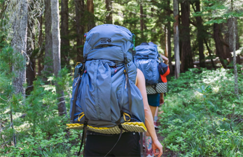
"Wearable Coach": Can a Smartwatch Really Replace a Mountain Guide?
By Michael J. Reynolds|Estimated reading time: 15 minutes| Last updated: May 8, 2026
Author Background: Michael J. Reynolds is a technology and outdoor systems writer covering the intersection of hiking, mobility, wearable devices, and emerging expedition technologies. His articles examine how developments such as satellite communication, AI-assisted rescue systems, advanced materials, and portable energy solutions are beginning to influence outdoor travel and backcountry safety. He is particularly interested in the practical impact of technology on self-supported trekking and wilderness experiences rather than speculative marketing claims. His work combines industry reports, product research, and long-form analysis to explore how outdoor equipment and mountain travel may evolve over the coming decade.
You've probably noticed it. Over the last few years, the way outdoor watch brands talk about their stuff has changed. It used to be about tracking—distance, elevation, heart rate. Now more and more ads lean on words like "guidance," "decision support," even "wrist coach." Some of them hint that your watch can fill in, at least partly, for a seasoned mountain pro.
If you're an experienced hiker, that idea is tempting. It also nags at you. Can a piece of wristwear really stand in for a living, breathing guide?
This isn't a puff piece for smartwatches, and it's not a hit job either. What we're going to do is spread the thing out on the table and look honestly at where a watch helps, where it doesn't, and—most importantly—where trusting it too much might quietly backfire. We're talking multi-day treks and alpine traverses here, the kind of routes where a guide would normally be a serious consideration, not a walk in the park.
What today's mountain-ready watches can actually do
Let's be fair. A current flagship outdoor watch is, in hardware terms, a genuinely capable piece of kit.
Technical white papers from Garmin and Suunto, published in 2024 and 2025, show multi-band, multi-constellation GNSS holding positional accuracy to within two meters in open terrain. Even in a canyon or under thick trees, reacquisition times have improved by roughly 30 to 40 percent compared to a few years back. Offline mapping is standard now. Coros packed global topo maps into a 2025 firmware update, and Apple has steadily layered more detailed contour data into its watchOS maps. Barometric altimeters and storm alerts—once the preserve of top-tier models—have trickled down to the mid-range.
On the health-sensing side, your wrist can track heart rate, blood oxygen, and in some cases skin temperature trends. But here's the thing: in the wild, those numbers aren't rock solid. A 2026 study published in JMIR Formative Research tested 10 commercial wearables in a climate-controlled lab, comparing neutral (23°C) and cold (10°C) conditions. The researchers found that climate conditions themselves didn't produce a statistically significant hit on optical heart rate accuracy. The bigger culprit was irregular movement—the stop-start shuffle of real hiking. Some of the better devices managed a mean absolute error around 5 bpm, while the worst performers strayed to 9–14 bpm. And keep in mind, that was in a lab. Add wind chill, sweat, and genuine alpine cold, and some user reports suggest gaps that widen further. Above 4,000 meters, SpO₂ readings get jumpy too, so a single snapshot number often doesn't say much.
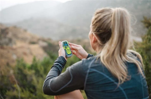
Emergency features have come a long way. Apple brought satellite SOS to the wrist starting with the iPhone 14 era, and Garmin's inReach integration has been around. Without cell service, you can trigger a distress call. Some models even manage two-way texts. But satellite coverage isn't seamless. In high latitudes or deep valleys, message delays of tens of minutes have shown up in user tests from 2025—far from the "instant" vibe some marketing suggests.
Then there's the battery. Around minus ten Celsius, with full multi-band GNSS running, what you actually get is often somewhere between 50 and 70 percent of the rated navigation life at room temperature. In practice, that usually lands in the 15-to-25-hour range—a conservative rule of thumb confirmed repeatedly in winter field tests by independent reviewers in Scandinavia and the Canadian Yukon.
Training load, recovery estimates, altitude acclimation nudges are also increasingly common. But the algorithms behind them lean on broad population models. They don't know your medical history, whether you're dehydrated, or if altitude-induced insomnia wrecked your night.
What a real guide does that a watch simply cannot
Look at that feature list and you might think a watch can do a lot. But if you've spent serious trail time with a professional guide, or even a deeply experienced mountain buddy, you already know the stuff they handle out there isn't in the same category.
A guide reads the whole mountain, not just coordinates.
The American Alpine Club's Accidents in North American Mountaineering (2025 edition) records several cases where groups followed a pre-loaded GPX track straight onto moraine loosened by summer melt, or onto a snow bridge that looked solid but wasn't. The track was technically correct. The mountain had changed. An experienced guide would have noticed the fresh sharpness of the scree, or heard the odd sound of water running under the glacier, and would have swung the group wide before anyone stepped onto questionable ground. That kind of judgment is built over season after season on the same terrain—pattern recognition no sensor can replicate. The International Federation of Mountain Guides Associations (IFMGA) dedicated an entire chapter to pattern recognition in risk assessment in its 2024 safety update. That's precisely the sort of intelligence a digital system can't code.
A guide reads people, and reads the group.
Within an hour of setting out, a skilled guide is already quietly sizing everyone up: whose stride has changed, who's gone quiet, whose gaze at the break looks a bit off. An observational study published in Wilderness & Environmental Medicine in 2024, looking at commercial alpine teams, noted that decisions to adjust pace or objectives were based on non-verbal cues around sixty percent of the time. Heart rate data and cadence stats can tell you someone is slowing down. They can't tell you if it's low blood sugar, fading confidence, or a blister forming deep inside a boot. At altitude, knowing which one it is matters.
A guide knows what maps don't show.
If you've done long routes, you've learned this the hard way. Public water-source data is often out of date: a spring marked on the map is bone dry, while a temporary stream that saved your night never appeared on any digital layer. Some high huts are still standing, others had their doors ripped off by winter storms—and that knowledge circulates verbally, not through a downloadable update. Mountain Rescue England and Wales (MREW) recorded 3,968 callouts in 2025, continuing a years-long upward trend, with a single peak Saturday in July generating 37 separate requests for help. CEO Mike Park told media outlets that incident reports increasingly show people lured into risky terrain by social-media posts, blindly following popular routes on their phones without understanding the hazards or current conditions. Very often, the core issue isn't a device malfunction—it's the hiker making wrong inferences from missing local detail.
A guide carries legal weight and psychological security you don't have to.
A certified guide holds insurance, has formal authority to coordinate a rescue, and is legally accountable for your safety. When your group has to pitch camp in a storm, the guide's presence is a stabilizer. A 2025 survey backed by the European Outdoor Group found that more than three-quarters of respondents listed "the guide made me feel safer" as a key reason for hiring one—and a solid chunk of those respondents weren't beginners. They'd done their own multi-day trips. That sense of reassurance is hard to quantify, but anyone who's made a hard call in bad weather knows it's not trivial.
When better performance creates a quiet risk
Here's the counterintuitive bit. The biggest risk with a smartwatch isn't that it suddenly fails. It's that it works so well most of the time that you gradually stop double-checking.
Psychologists call this "automation bias." When a system is usually right, your brain naturally dials down its own vigilance. It's well-documented in aviation and medicine, and outdoor incident data is starting to show a related shift. MREW's figures show callouts climbing in recent years—3,968 in 2025 compared to 3,784 in 2024—as outdoor participation grows and connected gadgets spread. Several mountain safety organizations also note that tech-dependency rescues are becoming more common, but it's usually a tangle of factors, not just one cause.
The typical error chain looks something like this. You spot a "shortcut" on the GPX track. The watch doesn't flag grade problems, exposure, or loose rock. So you go for it. But most GPX files don't encode that kind of hazard. The watch stays silent, not because the route is safe, but because it has no idea. Accidents in North American Mountaineering describes a case from Colorado's San Juans where a small team followed an apparently straightforward track down onto steep, rotten scree and became stranded. A rescue reached them in time. The post-incident analysis pointed out that if someone with independent terrain judgment or local knowledge had been in the group, the decision chain would probably have broken much earlier.
Battery drain is a simpler trap. Freezing temperatures and full navigation mode eat through power faster than many people realize. When the watch is your sole navigation tool, those final minutes before shutdown are when your risk spikes.
There's a subtle slide worth pausing on. The over-reliance problem isn't about hardware failure. It's about how the tool slowly rewires what you consider "prepared." In the past, being ready meant studying a contour map. Now it can mean downloading someone else's track. The device itself isn't dangerous. The quiet danger creeps in when the label "wrist coach" sinks deep enough that you forget judgment is supposed to live between your ears.
How to use a smartwatch as a decision-support tool—not a decision-maker
Instead of the big, binary question—can it replace a guide?—try this: most experienced hikers will carry both a watch and a set of analog skills. The smarter conversation is how to combine them without letting either side rust.
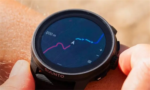
Don't hand the navigation lead to your watch.
A long-respected habit in Nordic and Scottish hillwalking circles goes something like this: map and compass handle the navigation, the watch handles confirmation. At a junction or a fuzzy section of trail, read the paper map first, then glance at the digital position, then cross-check with a visible landmark—a ridgeline, a river bend, a peak. Before leaving home, scroll through the entire route's offline maps on a proper screen and understand the logic of each segment. Don't just open a downloaded GPX file at the trailhead. You have no idea what season the original recorder went through, what fitness they had, or whether they straight-lined across a snowfield you'd rather avoid.
Treat health data as a nudge, not a diagnosis.
If your watch shows resting heart rate up by ten beats, take it as a quiet prod to drink more water, add a layer, or sit down for a few minutes—not a hard medical metric. A single SpO₂ spike or dip often means nothing more than the sensor shifted a millimeter on your wrist. Trends might be loosely informative. Hanging a major go/no-go call on them alone is shaky ground.
Learn your SOS feature in a safe place first.
Don't wait for a real emergency to discover how satellite messaging actually works. Different brands, different satellite networks, different coverage maps. In deep forest or a narrow valley, message queuing delays can stretch well past your expectations. Parks Canada's 2025 mountain safety page specifically notes that test messages sometimes take longer than fifteen minutes to go through, and they recommend running a full dry run before your trip. That muscle memory is worth more than any manual when your hands are cold and your mind is racing.
Keep investing in old-school skills alongside the tech.
After a trip, reviewing your route, heart rate, and elevation profile on your watch is a brilliant learning habit. You can spot where your judgment and reality didn't match. But using the watch to replace a formal avalanche awareness course, a wilderness first aid class, or a proper navigation workshop is heading the wrong way. Think of it as stacking, not swapping. The more capable your tech feels, the more deliberately you should spend time navigating without a screen, forcing your eyes and brain to rebuild raw terrain awareness. That dual capability is what keeps you on solid ground when the digital layer inevitably glitches or goes dark.
What the data and studies are starting to show
The evidence here is still piling up. No one should pretend this is settled science.
On one hand, several mountain safety organizations are noting a rise in "tech-assisted" callouts. The Swiss Alpine Club's 2025 incident analysis mentioned that a sizeable chunk of rescues involving smartphones and wearables happened on properly marked trails the user simply overlooked. That points to an attention problem, not a device failure.
On the other hand, these numbers need careful reading. More people are heading outdoors, and more of them are wearing connected devices, so absolute totals can creep up even if per-capita risk hasn't really shifted.
Academic work on GPS and spatial cognition offers some indirect clues. A 2021 quasi-experimental field study in the Journal of Outdoor Recreation and Tourism (Heggland and Haus) found that hikers who strictly followed turn-by-turn prompts had noticeably fuzzier route recall afterward, while map-and-compass users built clearer mental maps—even though both groups arrived in roughly the same time. For someone spending multiple days in one mountain zone, where weather might force route changes, that mental map matters enormously. It hints that different navigation styles may be quietly reshaping how you know the landscape, not just whether you got to camp.
As for biometric sensors in the cold, the 2026 JMIR controlled lab study indicated that in neutral versus moderately cold conditions, the main accuracy hit came from activity type, not temperature alone, with some devices showing deviations above 9 bpm—substantially more than the casual ±5 bpm assumption many of us carry in our heads. The practical takeaway: treat wrist-based health numbers as coarse trend indicators, not as precision instruments for life-or-death decisions.
Picking the right tool for what you actually want to do
In a market jammed with feature lists, a few old-fashioned sorting criteria will serve you better than spec sheets.
First, don't obsess over peak battery life. Look at real-world runtime in cold weather with full navigation on. Independent winter benchmarks are usually closer to what you'll actually encounter. A good rule of thumb: expect roughly 50 to 70 percent of the room-temperature claim when the mercury drops.
Second, ask whether the altimeter auto-calibrates reliably, whether map zoom feels snappy when your fingers are frozen, and whether the screen works with wet gloves. In truly miserable weather, these details matter way more than sensor count.
Third, different routes demand different things. A fastpacking trip cares about weight and endurance. A week-long traverse cares about map responsiveness. Mixed alpine ground adds the question of whether the watch will keep functioning strapped outside your jacket instead of buried under layers. No single watch nails all three perfectly.
Finally, keep an eye on firmware update history. A brand that regularly pushes fixes and doesn't abandon last year's model overnight is signaling something about long-term thinking, not just launch-day hype.
The strongest future is a partnership, not a handover
Sensors will get sharper. Satellite constellations will densify. Route-suggestion algorithms will grow more sophisticated. That much feels like a safe forecast.
But a human guide's core package—intuition baked over a decade on the same ridges, a well-timed question when morale starts to wobble, and the willingness to carry legal and moral weight for another person's safety—isn't something any line of code can easily touch.
The next time you see the phrase "wrist coach," it's probably healthiest to read it as a bit of copywriting, not a statement of fact. The smart approach is to carve out a zone where your watch does its job reliably, and never forget that judgment and consequence still live in the space between your ears, not on your wrist.
A smartwatch is a good teammate. It's not the captain.
FAQ
Can I rely mainly on a smartwatch for a difficult, unguided route?
Most mountain safety bodies would not recommend that. A watch helps confirm position, but it can't assess avalanche hazard, rock stability, or how your group is really doing—and on tough ground, those are often everything.
How reliable are offline maps and GPS outside cell range?
Position fixes in open terrain are usually solid, but signal loss in deep cover, map datum offsets, and battery drain are all well-known issues. Going without a paper map and compass means betting everything on a single point of failure.
What's the real battery life in cold weather with full navigation?
Independent tests typically show something in the 15-to-25-hour bracket below freezing. Cold is a fundamental physical challenge for lithium batteries, not something software can fully fix.
Can I trust altitude acclimation advice from my watch?
Treat it as a rough clue at best. The algorithm doesn't know your personal physiology, hydration level, or how you're actually feeling. Combine it with what your body is telling you.
Does the satellite SOS feature work everywhere?
No. Coverage varies by brand and satellite network. Delays in valleys and dense forest can be significant. Check the specific coverage map for your destination, and practice the full send sequence in a safe spot before you go.
References
[1] American Alpine Club. Accidents in North American Mountaineering 2025. Golden, CO: AAC Press, 2025.
[2] Mountaineering Scotland. “Mountain Safety: Phones, Apps and GPS.” 2024. https://www.mountaineering.scot/safety/
[3] Garmin. “Activity Tracking and Fitness Metric Accuracy.” Garmin Official Support Page. https://www.garmin.com/en-US/activity-tracking-fitness-metric-accuracy/
[4] Heggland, J. and Haus, M. “GPS Use and Spatial Orientation in Hikers: A Quasi Experimental Field Study.” Journal of Outdoor Recreation and Tourism, vol. 34, 2021, pp. 100–112.
[5] Swiss Alpine Club. Sicherheit im Bergsport: Jahresbericht 2025. Bern: SAC, 2025.
[6] Gielen, J., Van Oost, C.N., Debard, G., et al. “Accuracy of Optical Heart Rate Measurements for 10 Commercial Wearables in Different Climate Conditions and Activities: Instrument Validation Study.” JMIR Formative Research, 2026, vol. 10.
[7] Mountain Rescue England and Wales. “2025 Figures Show Another Challenging Year for Mountain Rescue Volunteers.” Emergency Services Times, 27 March 2026.
About the author
Michael J. Reynolds writes about the overlap between hiking, wearable technology, and backcountry safety. His work draws on industry reports, public product documentation, and long-term tech trends, with a focus on the real-world limits and practical worth of digital tools in self-supported wilderness travel.
Disclaimer
This article is for general informational and educational purposes only and does not constitute professional mountain-guiding advice, safety instruction, or medical guidance. Outdoor activities carry inherent risks that vary with weather, terrain, individual fitness, and equipment condition. Device functionalities described are based on publicly available documentation and may differ across firmware versions and environmental circumstances. Readers should undertake appropriate training, conduct independent pre-trip research, and consider hiring qualified mountain guides where suitable. The author and publisher disclaim any liability for actions taken based on this material.
Recommend for you:
Canister Stove vs. Liquid Fuel Stove: Which Cooking System for High-Altitude Trekking?
When you're walking a ridgeline at 4,000 meters carrying a week of gear, choosing a cooking system isn't just about making fire — it's a quiet argument with physics.
Durmitor National Park: Montenegro's Most Underrated Summit Destination
If you've grown tired of crowded Alpine trekking corridors in the Dolomites or the Swiss Alps, Durmitor National Park offers a very different mountain experience.
"Wearable Coach": Can a Smartwatch Really Replace a Mountain Guide?
You've probably noticed it. Over the last few years, the way outdoor watch brands talk about their stuff has changed. It used to be about tracking—distance, elevation, heart rate.
Tajikistan’s Fann Mountains: An Untouched Trekker’s Dream
For hikers who have already done a hut-to-hut traverse in the Alps or a few standard circuits in Nepal, the question of where to go next is shifting.