Tajikistan’s Fann Mountains: An Untouched Trekker’s Dream
Author: Elias Thorne|Release date: May 8, 2026 |Reading time: ~14 minutes
Author Background: Elias Thorne is an outdoor travel writer focusing on remote trekking routes, mountain communities, and long-distance hiking culture across Eastern Europe, Central Asia, and South America. His work centers on practical route analysis, seasonal conditions, and the realities of traveling in less-developed mountain regions rather than luxury tourism. He has spent years researching trekking infrastructure, trail logistics, and changing tourism patterns in destinations such as Albania, Montenegro, Oman, and Patagonia. His articles combine publicly available research, guidebook references, and field reports from hiking communities to help readers better understand remote routes before planning their own journeys.
For hikers who have already done a hut-to-hut traverse in the Alps or a few standard circuits in Nepal, the question of where to go next is shifting.
Industry watchers point to Tajikistan as a destination quietly gaining traction among experienced trekkers. And one name keeps coming up: the Fann Mountains.
Where it is, and why you haven’t heard of it
The Fann Mountains sit in the Sughd region of northwestern Tajikistan, wedged between the Zeravshan and Gissar ranges. They form the western edge of the Pamir-Alay mountain system. The range covers roughly 650 square kilometers, with close to a hundred peaks over 5,000 meters. The highest, Chimtarga, tops out at 5,489 meters.
Most trekking routes stay between 2,000 and 4,000 meters. That’s less extreme than the eastern Pamir, but “less extreme” does not mean easy.
The location isn’t actually remote — the mountains are just 130 kilometers from Samarkand as the crow flies. But for a long time, the combination of border-zone restrictions, visa hurdles, and rough access roads kept the area off the mainstream trekking map. That started to change in the late 2010s, as Tajikistan gradually opened up to tourism and trans-Asian road links improved.
According to the Tajikistan Statistical Agency, 2.1 million foreign nationals visited the country in 2025, a jump of 501,400 — up 31.3% year-on-year. Of these, roughly 171,900 came from non-CIS countries, including more than 13,000 from the United States, over 8,000 from Germany, and 3,000 from the United Kingdom. Most visitors still come from neighboring Central Asian countries, but the growth in long-haul markets suggests a country beginning to attract curious travelers from further away. A 2026 industry review by CMWP Uzbekistan noted that Tajikistan’s tourist numbers grew by 239% over the past decade — nearly 3.4 times — and described the country as “especially suited for adventure and niche tourism.”
Tourism infrastructure is in a slow but visible phase of growth. In early 2026, construction started on a new tourist complex at Lake Iskanderkul. The project, in the Fondaryo Jamoat area, covers 1.08 hectares and includes three three-story buildings, five single-story structures, parking lots, sports grounds, a restaurant-café, walking paths, and a children’s play area. The governor of Sughd region attended the groundbreaking. It’s the kind of project that signals a shift from scattered development toward something more coordinated.
But it’s important to be clear: in the core trekking zones — the Alaudin lakes and the Kulikalon basin — this kind of infrastructure hasn’t arrived. The trails remain in a fairly raw state. No cable cars. No mountain huts. No mobile signal. No signposts.
Four routes: from entry-level to ice axe required
The route information below pulls together details from Cicerone’s Trekking in Tajikistan, the Pamir Trail grading system, operator itineraries, and route updates on trekking community platforms.
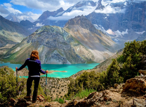
The Seven Lakes (Haft Kul)
Haft Kul — “Seven Lakes” — lies in the northwestern corner of the Fann range. The lakes step up from Mizhgon at 1,640 meters to Hazorchashma at 2,400 meters. The route is about 20.8 kilometers point-to-point, typically done in 2–3 days, but it can be broken into day hikes or shorter overnights.
The Pamir Trail, on the OutdoorActive platform, rates Stage 1 (Shing–Padrud–Haftkul) as T1 — the easiest technical grade. That said, some AllTrails users tag it as “challenging.” The discrepancy most likely reflects the overall physical effort and time on the trail, not technical difficulty.
Several villages along the Haft Kul route have homestays, which makes this the most logistically forgiving corner of the Fann Mountains. For trekkers who want to get a first taste of the range, it’s a sensible starting point. According to a hiking guide updated in March 2026, accommodation can be found near the lakes, so you don’t need to carry a full tent setup on this section.
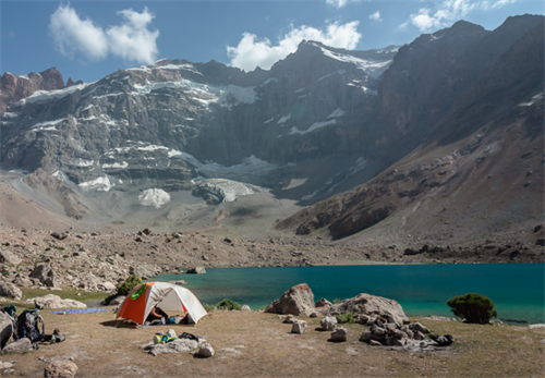
Alaudin–Kulikalon Circuit
This is the most documented and most walked route in the Fann Mountains.
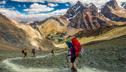
Most trekkers start at Artuch Alplager (around 2,200 m), climb past the Kulikalon lakes to the Alaudin Pass (3,860 m), then descend to the Alaudin lakes. The full loop measures about 50 kilometers with roughly 3,130 meters of cumulative elevation change. It usually takes between four and six days.
The crux is Alaudin Pass. Multiple operator itineraries describe sustained climbing on both sides. Operators typically rate the pass-crossing day as the hardest of the trip, with around six to seven hours of walking. The descent is on loose scree. It demands stability in the knees and ankles and demands focus — this isn’t a section where you walk and take photos at the same time.
One worth-noting detail: feedback from trekkers posted in March 2026 described some of the lakeside campsites at Alaudin and Kulikalon during July and August as resembling “more of a high-altitude tent village than a solo expedition camp.” That’s not necessarily a negative — it means these zones are reasonably established and attract a trekking community — but it does bump up against any marketing imagery of utter solitude. If serious solitude is what you’re after, you may want to aim for weekdays or push into September.
Chimtarga Pass: where trekking ends and mountaineering begins
Chimtarga Pass sits at around 4,750 meters. It’s the highest point accessible on a commercial itinerary in the Fann Mountains.
Let’s be direct: multiple operators describe this as a serious challenge even for experienced mountaineers. A Tajikistan expert on the Caravanistan forum stated that in June the pass has “no chances for crossing” — deep snow, avalanche risk, and ice fields covering the route in many places make it extremely dangerous, and the window usually doesn’t open until early August. The same source noted that even in June, trekkers could still face 5–10 kilometers of snow cover around Dugdon, depending on the conditions of the year.
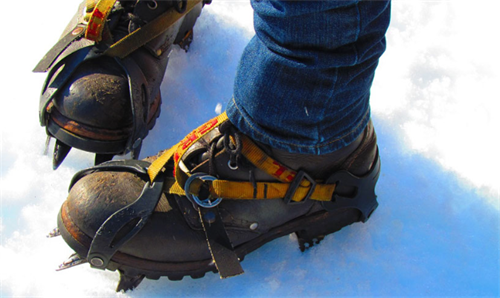
The route near the pass is often indistinct, and route-finding itself becomes a challenge. Track logs and photos confirm that you need crampons and an ice axe, and you will cross glacier sections. Operators like Apricot Tours list Chimtarga Pass at 4,750 meters and describe the trek as “challenging,” passing multiple alpine lakes and snowy peaks.
For independent trekkers who don’t have mountaineering goals, it’s essential to understand the distinction: here, “trekking” has shifted into the realm of traditional mountaineering. In some conditions, it may fall into the UIAA grade 2A–2B range. Commercial trips usually run 7–9 days, with acclimatization around the Alaudin lakes before approaching the pass. Anyone without relevant snow-and-ice experience is strongly advised not to attempt this independently.
Mutnye Lakes side route
Mutnye Lakes sit at the foot of Chimtarga Peak, their water the milky shade typical of glacial flour. The descent via Zindon Gorge is mentioned on maps and in published itineraries.
The trail is sparsely marked and often requires wading through water. Commercial trips arrange pickups with pre-positioned vehicles at the Zindon River. Independent trekkers need to figure out their own logistics — or find a ride once they reach the villages at the gorge exit. This route makes sense for people who already have some Fann Mountains experience and feel comfortable with GPS navigation and backcountry river crossings. If it’s your first visit, it may be better to put this one on the next-trip list.
Visas, permits, and getting there
Tajikistan offers an e-visa system for most EU and North American passport holders. Applications are made through the official government site (www.evisa.tj). The visa is typically valid for 60 days within a 90-day period, with processing taking 2–5 working days. Fees are 30forsingleentry,30forsingleentry,50 for multiple entry.
One crucial detail: the Fann Mountains lie outside the Gorno-Badakhshan Autonomous Region (GBAO). You do not need a GBAO permit to trek here. Visitors entering on an e-visa are not required to register with OVIR. However, those entering under a visa-free regime and staying more than 10 working days do need to register. If you plan to travel to the Pamir region as well, you can add the GBAO permit when you apply for the e-visa — it costs an extra $20.
Before departure, check a regularly updated visa guide like Caravanistan for any changes — Tajik visa rules have a track record of shifting. Several experienced trekkers also emphasize printing a paper copy of your e-visa. Border officials may not accept a digital version on your phone.
For transport, most trekkers use Dushanbe as a hub, then travel by road to Panjakent and onward to the Artuch area. The stretch from Panjakent to Artuch Alplager requires a 4×4. Parts of the road are unpaved, and the drive takes about 2.5–3.5 hours depending on conditions. An alternative is to take a shared taxi from Panjakent to Artuch village, then walk the last seven or eight kilometers uphill to the camp. Another common approach route enters from Samarkand in Uzbekistan via the Jartepa border crossing, then continues to Panjakent and into the mountains.
In recent years, some small-group European operators have started adding the Fann Mountains to their offerings. In May 2026, Jules Verne announced two new Tajikistan itineraries. The 7-night “Tajikistan Highlights” includes the Marguzor lakes (Seven Lakes), with prices starting at £1,095 per person and first departures in September and October 2026. A longer 13-night combination links the Fann Mountains with Silk Road cities like Samarkand and Bukhara, starting at £2,395 per person. It’s another signal that the Fann Mountains are moving from a purely independent trekker’s destination into the orbit of organized small-group travel.
The reality of no signal
The core trekking areas of the Fann Mountains have almost no mobile network coverage. Operator records and previous trekkers’ notes confirm that you might pick up an unstable 2G signal around Artuch camp or at a couple of spots near the Seven Lakes. Once you’re deeper in the valleys, it’s gone.
The workable communication options right now are renting an Iridium satellite phone or a device like a Garmin inReach. This isn’t an add-on. In an environment with essentially no search-and-rescue infrastructure, it’s a key part of your safety margin.
Altitude: don’t skip the acclimatization process
According to the Wilderness Medical Society’s 2024 guidelines, traveling above 2,500 meters is associated with the risk of developing one or more forms of acute mountain sickness (AMS). Symptoms are usually headache-dominant, sometimes with nausea, fatigue, and dizziness. In the Fann Mountains, most campsites and trails sit at or above this threshold — camps on the Alaudin–Kulikalon circuit are typically between 2,700 and 2,800 meters, and Alaudin Pass tops out near 3,900 meters.
The same guidelines recommend that above 3,000 meters, sleeping altitude should not increase by more than 500 meters per day, and a rest day should be included. The problem: Dushanbe sits at roughly 800 meters. Going straight from the capital into the mountains leaves almost no room for gradual adaptation. Experienced operators generally suggest spending one or two nights in the Artuch area or Seven Lakes villages, doing low-intensity day walks before starting sustained ascents.
Research on climbers attempting Muztagh Ata (a 7,509-meter peak on the eastern edge of the Pamir) has shown that even a few days’ difference in acclimatization schedules can significantly affect both the severity and the incidence of AMS symptoms.
The treatment for AMS is straightforward and non-negotiable: descend at least 1,000 meters immediately. No exceptions. In a range with no hyperbaric chambers and no helicopter rescue, that’s a line worth memorizing.
Environmental pressure and responsible travel
Tourism in the Fann Mountains has expanded faster than the infrastructure and environmental management systems can handle. This was documented in a destination analysis published by Geo Tajikistan in 2020. The report noted that the late 2010s saw hundreds of small homestays and guesthouses spring up in mountain villages — creating income opportunities but also putting pressure on local water supplies and waste disposal systems.
The environmental impact is most visible around the most accessible lakes and along popular trail segments. Informal lakeshore campsites lack sanitation facilities. Trash accumulates on some heavily used sections. Steady foot traffic widens narrow scree trails and triggers soil erosion. At Lake Iskanderkul, early signs of eutrophication have been recorded — algae blooms near the shore appearing earlier than in the past. Local researcher Kayumov (2010) linked this to grey water seeping into the lake from tourism facilities. On steep scree slopes, trail widening and shortcutting have also caused slope instability, in some cases triggering small slides or gully erosion.
Geo Tajikistan’s report quoted a guesthouse owner from Artuch: “Before, only shepherds and a few mountaineers came here. Now every weekend buses come from the cities. We like having the business, but the mountains are changing too fast.” This community voice isn’t an argument to stay away — it’s a reminder that the Fann Mountains are in the middle of a transition.
A few ground rules don’t need much elaboration: camp at least 60 meters from water sources. Pack out all your trash. If conditions allow and you find waste left by others along the trail, picking some up is a small contribution. In villages with homestays, choose locally owned places. Hiring a local guide or porter isn’t just a safety choice — it’s also the most direct way your spending supports the mountain economy. Environmental researchers have flagged the Fann Mountains as an important site for studying sustainable tourism development, but as of now the area still lacks systematic waste collection and treatment facilities. Every trekker who walks these valleys is, in practice, taking part in a management process that’s still taking shape.
When to go
Most operators set the prime window between mid-July and mid-September. A Fann Mountains guide published by AdventureBound notes that daytime valley temperatures typically range from 20°C to 30°C, but at altitude nighttime temperatures can drop to near freezing — even in July and August. The trekking season usually runs from late June through mid-September, when most pass snow has melted and the lakes show their strongest colors.
In June, snow on the passes and meltwater floods can make progress much harder and more dangerous. The Caravanistan forum discussion on Chimtarga specifically points out that even in mid-June, you could face 5–10 kilometers of continuous snow on the Dugdon approach, depending on annual conditions.
After mid-September, herders pull out of the high pastures, and some of the simple bridges maintained by locals can get damaged or dismantled, making river crossings tricky. The last week of August into early September, with colder nights but still stable daytime conditions, may offer the most balanced window of the season.
FAQ:
Can you trek independently in the Fann Mountains?
The Alaudin–Kulikalon circuit is feasible in July through September for trekkers with solid map-reading and GPS navigation skills. That said, the lack of trail markers and the near-total absence of rescue infrastructure raise the risk level considerably if you’re alone. The Chimtarga Pass route is not recommended as an independent undertaking.
Do I need a tent, or are there huts?
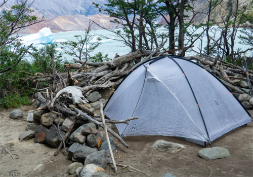
There is no mountain hut network in the core trekking areas. Apart from Artuch camp and some villages along the Seven Lakes, a tent is mandatory. Some commercial trips provide tents and meals; independent trekkers need to carry their own full camping setup.
Is it safe for women and minority travelers?
There are no publicly available quantitative studies specifically assessing safety in the Fann Mountains. Based on community notes and publicly shared reports, villagers in the mountains have generally responded to visitors with curiosity and hospitality. Standard outdoor clothing does not draw extra attention. In public transport and accommodation outside cities, it’s sensible to follow the same basic precautions you would apply anywhere you travel.
Can I resupply food along the way?
Homestays in Artuch village and the Seven Lakes can provide basics — bread, rice, potatoes, and tinned goods. Fresh fruit and vegetables are almost nonexistent in most seasons. Plan to buy all your main meals and trail snacks in Dushanbe.
References
[1] Bakker, J. & Oriol, C. Trekking in Tajikistan: The Northern Ranges, Pamirs and Afghanistan's Wakhan Corridor. Cicerone Press, 2018.
[2] The Fann Mountains: Tourism, Ecology, and Pressure. Geo Tajikistan, 2020.
[3] CMWP Uzbekistan. Central Asia Hospitality Industry Review (Tajikistan section). 2026.
[4] Tajikistan Statistical Agency. “More Than 2.1 Million Foreign Nationals Visited Tajikistan in 2025.” February 2026.
[5] Asia-Plus. “Construction of a New Tourist Complex Begins at Lake Iskanderkul.” January 2026.
[6] Wilderness Medical Society. “2024 Altitude Illness Guidelines.” Wilderness & Environmental Medicine, 2024.
[7] Caravanistan Forum. “Fann Mountains – Chimtarga Pass Trek in June – Snow Conditions?” User discussion, 2025.
[8] TravelDoc. “Things You Should Know When Applying for a Tajikistan e-Visa.” July 2025.
[9] Pamir Trail / OutdoorActive. Stage 1: Shing – Padrud (Haftkul), 2025.
Disclaimer
This article is based on publicly available sources, including published guidebooks, operator itineraries, academic literature, and travel industry news. The difficulty assessments, gear suggestions, and safety notes reflect general conditions during specific seasons and weather windows. Mountain information is time-sensitive. Visa rules, permit requirements, and trail conditions can change after publication. Trekking and mountaineering involve inherent and unpredictable risks. Readers should assess their own abilities and risk tolerance and are strongly advised to arrange trips through a licensed Tajik tour operator or certified guide. The author and publisher accept no legal liability for any injury, loss, or delay resulting from the use of this information.
Recommend for you:
Crampons vs. Microspikes: What You Need for Spring Snow Hiking
Spring snow hiking — roughly March through May in the Northern Hemisphere — has a way of fooling you.
Mycelium-Based Gear: How Mushrooms Are Becoming the Future of Hiking Equipment
By 2026, mycelium leather isn't just a lab curiosity anymore.
Mountain Loop Fastpacking: Trail Runners vs. Hiking Boots
Fastpacking a mountain loop—whether you're cranking out huge miles and vert in a single day, or moving light over two to four days—puts your footwear in a weird bind.
How 3D-Printed Trail Food Might Change Your Backcountry Cooking Menu
Backpacking food hasn’t changed much in decades. You’ve got freeze-dried pouches, energy bars, oatmeal, nuts with chocolate. They pack calories, weigh little, and last forever. But exciting? Not really.