Hiking the Accursed Mountains: A Complete Guide to Northern Albania
By Elias Thorne |Release Date: May 8, 2026, based on sources available through April 2026| Reading time: ~15 minutes
Author background: Elias Thorne is an outdoor travel writer focusing on remote trekking routes, mountain communities, and long-distance hiking culture across Eastern Europe, Central Asia, and South America. His work centers on practical route analysis, seasonal conditions, and the realities of traveling in less-developed mountain regions rather than luxury tourism. He has spent years researching trekking infrastructure, trail logistics, and changing tourism patterns in destinations such as Albania, Montenegro, Oman, and Patagonia. His articles combine publicly available research, guidebook references, and field reports from hiking communities to help readers better understand remote routes before planning their own journeys.
Online information about northern Albania’s Bjeshkët e Nemuna – often called the Accursed Mountains – tends to fall into two camps.One side still describes the region through the lens of 1990s political instability. The other calls it “Europe’s last secret.”
Both narratives skip over what actually matters. Spending eight hours on a thinly marked limestone trail, without a mountain hut network and without phone signal, demands a specific combination of judgement and logistics.
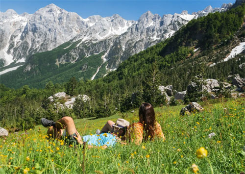
This guide is written for hikers who have already completed established routes in the Alps, the Pyrenees or the Colorado Rockies. Here, you won’t find the million-footprint paths of the Swiss Alps. Trail conditions remain raw.
Cicerone’s guide (Abraham, 2019) describes the full “Peaks of the Balkans” circuit as approximately 192 km long, split into 10 stages that typically take 10–14 days. The key section in northern Albania connects two valleys: Theth and Valbona. For the foreseeable future, trail maintenance is expected to rely mostly on local, voluntary marking efforts.
No known trail hazard is downplayed or dressed up in this article.
Terrain and trail conditions: What’s under your boots
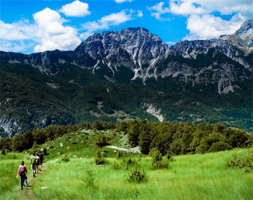
The northern Albanian Alps form part of the southern Dinaric range. Their geology is dominated by Mesozoic karst limestone. That single fact shapes almost every step you take.
In dry weather, the shattered, greyish limestone gives surprisingly strong grip. But when a thin film of wet mud covers the rock – common during snowmelt or after an afternoon storm – the surface becomes as slick as wet limestone slabs on a high Alpine route. Multiple GPS trip logs from Wikiloc (2023–2025) confirm that these rapid surface changes catch hikers off guard.
Trail markings are minimal. Some stretches show red-and-white paint blazes spaced up to 200 metres apart (BalkanTrek.com, trail condition report, 2024). There are no reflective markers, no carved steps, and few reassurance signs. In fog or fading light, it’s easy to wander off-route.
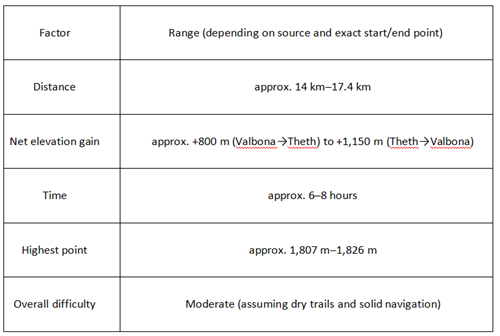
The classic Theth–Valbona crossing covers roughly 14–17.4 km. Net elevation gain ranges from approximately +800 m (Valbona to Theth) to +1,150 m (Theth to Valbona). A fit group normally needs 6–8 hours. These figures are drawn from Abraham (2019) and cross-referenced with user-uploaded GPS tracks on OutdoorActive and Wikiloc (accessed 2023–2025). Most guidebooks rate the route “moderate,” but that rating assumes dry trails and good visibility.
Stream crossings are a real challenge. The area has almost no footbridges. During snowmelt or after heavy rain, streams that are normally rock-hoppable become fast-moving and deep enough to compel wading. Footwear advisors (American Hiking Society, 2024) specifically warn against removing boots for a crossing: underwater limestone shards can inflict worse cuts than slippery rocks.
The ridgelines near the Montenegro and Kosovo borders are unusually exposed. Guardrails are absent on plenty of sections where a Western European trail would have them.
The seasonal window: Reading the mountain calendar
Summer – June through September – is the broadly accepted hiking season, but treating all months equally can lead to serious miscalculation.
Early June:
The north side of the Valbona Pass often still holds large, compact snowfields. Hikers are frequently pushed onto steep scree gullies as alternate lines. Snowmelt also pushes stream volumes to their annual peak, making some crossings temporarily impassable. Several Wikiloc track notes from June 2024 describe needing to scout upstream for safer fords.
Late July through August:
This is the most settled dry-weather window. However, afternoon thunderstorm frequency rises sharply. A rule cited by mountain safety resources such as the UIAA (International Climbing and Mountaineering Federation) is to drop back below the treeline by 4:00 pm. Local guesthouse owners, according to anecdotal trip reports on Inside Balkan (2024), often give the same advice unprompted.
Mid to late September:
Visitor numbers drop noticeably. The beech forests begin to turn, drawing photographers. The trade-off: boat services on Lake Koman thin out. BalkanTrek.com (autumn 2025 update) notes that after mid-September, only one or two boats may run per day, and cancellations are more likely in bad weather.
Also, expect high densities of horseflies in July. They don’t transmit disease, but the constant buzzing and biting through pine forest sections has been described in multiple hiking blogs as a genuine drain on morale and pace.
The core route: Theth–Valbona crossing
The data below combines figures from the Cicerone guide (Abraham, 2019) with a range of publicly available GPS tracks (Wikiloc, OutdoorActive, 2023–2025). The numbers are intended as planning benchmarks, not precision guarantees.
Section-by-section conditions:
Leaving Theth (≈700–750 m): The trail crosses farmland and scrub, with tread that is generally clear. Water sources near the village should be treated before drinking (CDC, 2026 travel health information for Albania).
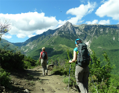
The sustained climb: Above the treeline, you move onto open limestone scree slopes. Sun exposure is intense. Blazes can become sparse here; check rock faces, not just eye-level markers.
At the pass (≈1,800 m): Wind gusts can shift suddenly. On a clear day the ridgeline opens views west toward Montenegro. In fog – which builds quickly in the afternoon – these landmarks vanish.
Descending to Valbona: Downhill sections alternate between loose scree and grass slopes slick with dew or seepage. Trip reports consistently note that wet grass is more treacherous than dry rock slabs. Once inside the forest, markers generally reappear at more regular intervals.
Key safety note:
Smartraveller (Australian Government, advisory reviewed April 2026) warns that outdoor operators in Albania do not always follow uniform safety and maintenance standards, and that several hiking trails suffer from inadequate signage. This means personal responsibility is higher than on managed trails in the Alps. If fog, rain or fading light arrives, the evidence-based choice is to cut the day short.
Alternate and bail-out options:
A shortened loop via Çerem can serve as a retreat route. But BalkanTrek.com (2024) flags that this forest path is often blocked by fallen trees. Expect to duck through low branches and undergrowth.
For a multi-day border crossing, the “Peaks of the Balkans” circuit is about 183–192 km (Abraham, 2019). It crosses Albania, Montenegro and Kosovo and requires advance border-crossing permits.
Accommodation, supplies and money
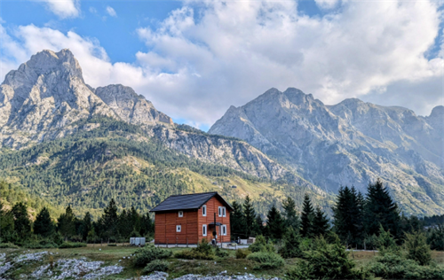
Accommodation: Almost all lodging consists of family-run guesthouses. These are not standardised Alpine huts. Booking platform reviews (Booking.com, Airbnb, aggregated 2024–2025) commonly mention dormitory-style sleeping (separate for men and women) and showers heated by solar panels – cold water on overcast days. Hospitality, however, is consistently described as warm, with meals provided in large portions.
Supplies: Village shops usually stock biscuits, white cheese, apples and canned goods. All other provisions should be brought from Shkodër. Above approximately 1,800 m, natural water sources become unreliable. The standard recommendation (CDC, 2026) is to carry at least two litres per person per day.
Water quality: The CDC advises that tap water in Albania may contain bacteria and viruses due to ageing pipes and inconsistent treatment. Stream water often runs through land used by livestock. Treat all water with a filter, purifier or chemical disinfection tablets. Stomach illness is one of the most common trek-ending problems reported on travel forums.
Money: Cash is king in the mountains. Albanian lek (ALL) is required for guesthouses, tiny shops and boat crossings. Data from the European Central Bank’s payment statistics (2023) and card network coverage maps show Albania has lower card acceptance than most of Western Europe, and some small operators remain cash-only.
Key gear and navigation
Based on a synthesis of recommendations from the Cicerone guide, the American Hiking Society and hiker trip reports:
Trekking poles: Essential for the long, loose scree descents. They reduce knee strain and help with balance on shifting rock.
Footwear: Mid-cut boots with a protective toe cap are strongly advised. Low-cut shoes leave toes vulnerable to sharp limestone. Do not remove boots at stream crossings; underwater shards are abrasive and sharp.
Rainwear and insulation: Thunderstorms can arrive with little warning. A waterproof jacket and a warm layer are standard for every day out, even under a blue morning sky.
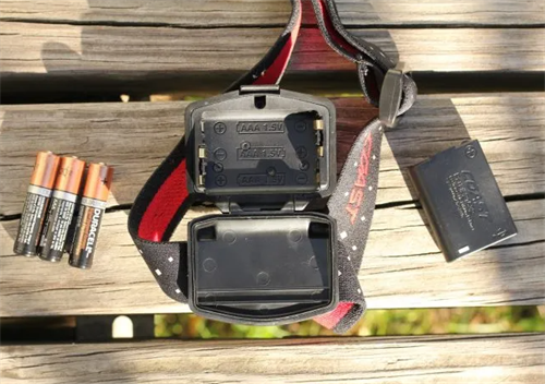
Paper map and compass: Phone compasses have been reported to behave erratically in some narrow valleys. A paper topo map (1:50,000) and a compass remain the recommended backup.
Offline navigation: Apps like OsmAnd and Mapy.cz with Balkan offline layers are widely reported to work well across most of the route. However, no app is fully reliable on trails that are infrequently updated on digital maps. Additionally, mobile signal is absent for an estimated 90% of the trek.
Safety and risk
Separate the risks into two categories.
Terrain and weather: Lightning strikes are a known hazard on exposed ridgelines during summer afternoons. If hair begins to stand on end, the risk is immediate. The UIAA recommendation: descend right away, crouch low with feet together, and avoid isolated trees. Tree strikes have been documented by hikers in this area (SummitPost Prokletije forum, 2022). No hut or shelter exists on the high sections, so self-reliance is critical.
Dogs: Livestock guardian dogs, usually large and white, are common. They react defensively to strangers near flocks. Advice from the American Veterinary Medical Association (2023) and repeated in Balkan travel resources: speak in a calm, low voice, avoid direct eye contact, turn sideways, and back away slowly. Never run.
Communication: There is virtually no mobile signal on the trail. A satellite messenger or PLB (personal locator beacon) is advisable. Tell your guesthouse your planned route and expected arrival time before setting out.
Lastly, while violent crime against tourists is extremely rare (Smartraveller, 2026), normal precautions apply on quiet trails.
Insurance: Your policy must explicitly cover trekking up to ≈2,700 m and helicopter rescue. Check that the Western Balkans are included in the geographical coverage before purchasing. International providers such as World Nomads list this as a standard confirmation step.
Getting there and getting out
Most hikers reach the mountains from Shkodër via the Koman Lake ferry to Fierzë, then a minibus to Valbona or Theth. Abraham (2019) describes this approach in detail.
The ferry ride takes roughly 2.5–3 hours. The fare is around €10, though BalkanTrek.com (2025) notes that cash in lek is preferred and prices might differ slightly between operators. Schedules are informal. Calling a guesthouse or a local driver to confirm the next day’s departure time is more reliable than any online timetable.
The mountain roads are mostly unpaved. Rain can turn sections muddy. Reports from Inside Balkan (2024) mention that after heavy rain, minibus drivers sometimes wait a few hours for the road to dry enough for a safe passage.
Important: The Theth–Valbona crossing does not require a hiking permit. However, if you join the “Peaks of the Balkans” international route, you must obtain border-crossing permits in advance. Carry a physical copy of your passport.
Cultural cues and ethical trekking
Photography: Pointing a lens at someone without permission can cause discomfort, especially with women and older people. Young Albanians often speak some English or Italian. Asking “May I?” and showing the screen afterwards goes a long way.
Your financial footprint: Paying for a family-run guesthouse directly supports local firewood stocks and school transport. A 2023 study on tourism in the Albanian Alps published by the GIZ (German development agency) highlights that small-scale, community-based accommodation channels significantly more revenue into the local economy than larger outside-owned lodges.
Respecting place and belief: Locals sometimes say the mountains have their own will. Whether you share that view or not, keeping noise down during a thunderstorm is both practical and culturally sensitive.
FAQ
Can I hike Theth–Valbona without a guide?
Yes, if you have solid navigation skills and go during settled summer weather. Most reports of hikers getting lost on this route come from afternoon fog conditions. Be aware that trail signage is not maintained to a consistent standard.
Do I need to speak Albanian?
No. Many guesthouse owners in their 20s and 30s speak basic English or Italian. Knowing “Faleminderit” (thank you) and “Sa kushton?” (how much?) helps build goodwill.
Is the area safe?
Violent crime against tourists is extremely rare. The main risks are terrain, weather and encounters with guardian dogs. For the latest safety overview, refer to the Smartraveller Albania advisory.
How do I treat water?
Assume all surface water is unsafe. A water filter or UV purifier is essential. Stomach problems are one of the top reasons treks get cut short. The CDC recommends against drinking untreated tap or stream water in Albania.
Do I need mountain rescue insurance?
Yes. Your policy must cover trekking up to 2,700 m and helicopter evacuation. Confirm in writing that the Western Balkans are included.
Are permits required?
The Theth–Valbona day crossing does not require a permit. The “Peaks of the Balkans” international route requires advance border permits.
Further reading and resources:
These are the core sources referenced throughout this guide, plus additional tools for trip planning:
1. Abraham, R. The Peaks of the Balkans Trail (Cicerone, 2019). Provides stage-by-stage profiles, elevation gain charts, and border-permit guidance.
2. SummitPost.org – Prokletije section. Continuously updated information on snow, water and route conditions; often more current than printed books.
3. BalkanTrek.com. A non-profit database listing trail closures and local updates. Check just before your trip.
4. Smartraveller.gov.au – Albania page (reviewed April 2026). Covers safety, medical-facility limitations, and outdoor activity risks.
5. CDC Travelers’ Health – Albania (accessed April 2026). Detailed guidance on water safety, vaccines and food precautions.
6.MeteoAlarm.org. European severe weather warnings. Cross-check on the morning of your hike, paired with a local forecast app.
Disclaimer
This article synthesises information from publicly available sources; it is not a real-time weather or geological bulletin. Trail conditions, water levels, services and regulations can change without notice. Before departure, check official weather warnings, road information and local regulations. All outdoor activities carry inherent risks including, but not limited to, falls, hypothermia, lightning strikes, dog bites and waterborne illness. Each hiker is responsible for assessing their own abilities and for every decision taken on the trail. The authors and publisher accept no liability for injury, loss or legal consequences arising from the use of this guide.
Recommend for you:
Dientes de Navarino Circuit: A Wilderness Trek at the End of the World
The route is a loop across the island’s jagged mountain spine. It measures roughly 53 to 54 kilometres, a figure confirmed by the official leaflet from Chile’s Ministry of National Assets and the independently produced Kanaska Maps project.
Bieszczady: Poland's Remote Eastern Wilderness
The Bieszczady Mountains sit at Poland's southeastern corner, bordering Slovakia and Ukraine.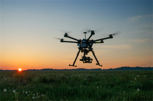
No More Missing Hikers? How AI-Powered Search-and-Rescue Drones Operate
Hikers go missing for reasons that sound almost mundane: a weather front rolls in faster than expected, someone loses the trail, a phone battery dies, and the last thread of contact snaps.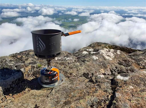
Canister Stove vs. Liquid Fuel Stove: Which Cooking System for High-Altitude Trekking?
When you're walking a ridgeline at 4,000 meters carrying a week of gear, choosing a cooking system isn't just about making fire — it's a quiet argument with physics.